
IMAGES TAKEN NEAR TO
Hilltop Road, REIGATE, RH2 7HL
Introduction
This page details the photographs taken nearby to Hilltop Road, RH2 7HL by members of the Geograph project.
The Geograph project started in 2005 with the aim of publishing, organising and preserving representative images for every square kilometre of Great Britain, Ireland and the Isle of Man.

There are currently over 7.5m images from over14,400 individuals and you can help contribute to the project by visiting https://www.geograph.org.uk
Image Map
Images are licensed for reuse under creativecommons.org/licenses/by-sa/2.0
Notes
- Clicking on the map will re-center to the selected point.
- The higher the marker number, the further away the image location is from the centre of the postcode.
Image Listing (119 Images Found)
Images are licensed for reuse under creativecommons.org/licenses/by-sa/2.0
Image
Details
Distance
1
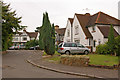
Hilltop Road
A group of 1930s semi-detached houses set round a circular shrubbery, off Smoke Lane.
Image: © Ian Capper
Taken: 26 Jul 2009
0.01 miles
2
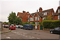
Smoke Lane
Large Edwardian houses opposite Hilltop Road.
Image: © Ian Capper
Taken: 26 Jul 2009
0.03 miles
3
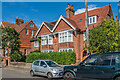
Smoke Lane
Houses in Smoke Lane. The one here (nos 12 - 14) has a date plaque of 1900, ten years later than the one partly seen on the left (nos 16 - 18 - see Image) which dates from 1890.
Image: © Ian Capper
Taken: 31 Aug 2020
0.03 miles
4
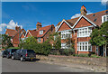
Smoke Lane
Houses in Smoke Lane. The nearest one here (nos 8 - 10) has a date plaque of 1901, that beyond (nos 12 - 14 - see Image) one of 1900 and that partly seen on the far left (nos 16 - 18 - see Image) one of 1890.
Image: © Ian Capper
Taken: 31 Aug 2020
0.03 miles
5
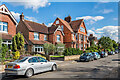
Smoke Lane
Houses in Smoke Lane. The large one in the centre (nos 16 - 18) has a date plaque of 1890 and is the only one marked on the 1898 1:2,500 map. The ones beyond are marked on the 1914 edition but not the nearest ones which first appear on the 1935 edition.
Image: © Ian Capper
Taken: 31 Aug 2020
0.04 miles
6
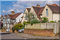
17 & 19 and 21 & 23 Smoke Lane
c.1920s semi-detached houses in Smoke Lane.
Image: © Ian Capper
Taken: 14 Jul 2021
0.04 miles
7
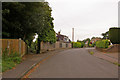
Smoke Lane
The footpath to the left is part of the original Smoke Lane, leading down to Cockshot Hill (see Image). When the area was developed, the extension round to the right was given the same name.
Image: © Ian Capper
Taken: 26 Jul 2009
0.06 miles
8
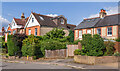
7, 9, 11 and 13 & 15 Smoke Lane
A group of three detached houses and one pair of semi-detached cottages in Smoke Lane, all dating from the early 20th Century.
Image: © Ian Capper
Taken: 14 Jul 2021
0.07 miles
9
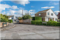
Orewell Gardens
1960s cul-de-sac off Smoke Lane (in the foreground).
Image: © Ian Capper
Taken: 31 Aug 2020
0.07 miles
10
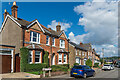
Springcopse Road
Late 19th/early 20th Century houses in Springcopse Road.
Image: © Ian Capper
Taken: 31 Aug 2020
0.07 miles