
IMAGES TAKEN NEAR TO
Fairford Close, REIGATE, RH2 0EY
Introduction
This page details the photographs taken nearby to Fairford Close, RH2 0EY by members of the Geograph project.
The Geograph project started in 2005 with the aim of publishing, organising and preserving representative images for every square kilometre of Great Britain, Ireland and the Isle of Man.

There are currently over 7.5m images from over14,400 individuals and you can help contribute to the project by visiting https://www.geograph.org.uk
Image Map
Images are licensed for reuse under creativecommons.org/licenses/by-sa/2.0
Notes
- Clicking on the map will re-center to the selected point.
- The higher the marker number, the further away the image location is from the centre of the postcode.
Image Listing (62 Images Found)
Images are licensed for reuse under creativecommons.org/licenses/by-sa/2.0
Image
Details
Distance
1
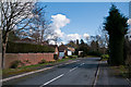
Fairford Close
1980s cul de sac off Brightlands Road.
Image: © Ian Capper
Taken: 18 Mar 2012
0.02 miles
2
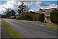
Brightlands Road
The 1871 large scale map of Reigate shows Brightlands Road as a cut between Wray Park Road and Raglan Road, with only one large house in the road, surrounded by extensive grounds. This was Brightlands, situated where the modern house on the right of the photo now stands. It was only in the 1950s that the road started being developed further, with a few houses being built in the grounds of Brightlands, and it was not until the 1970s that Brightlands itself was demolished, to be replaced by the house seen here.
The historic importance of Brightlands was that it was the home of the Victorian photographer, Francis Frith, whose photographic printing works was in Reigate - see Image
For photos of the original house see http://www.francisfrith.com/reigate/photos/brightlands-c1885_r20312 and http://www.francisfrith.com/reigate/photos/francis-frith-at-brightlands-c1885_r20311 (the latter showing Francis Frith himself relaxing in the garden of the house).
Image: © Ian Capper
Taken: 18 Mar 2012
0.03 miles
3
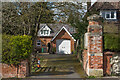
Alvington Cottage
House at 61 Wray Park Road, a former outbuilding to Alvington House (see Image).
Image: © Ian Capper
Taken: 12 Apr 2021
0.05 miles
4
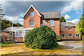
Alvington House
House at 59 Wray Park Road. The core is a large Victorian house, but its subsequent use as a retirement home saw it being extended. It closed in the late 2010s and its future use is uncertain.
Image: © Ian Capper
Taken: 12 Apr 2021
0.05 miles
5
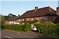
Wray Park Road
1960s block in Wray Park Road on what was the grounds of St Davids (see Image).
Image: © Ian Capper
Taken: 27 May 2012
0.09 miles
6
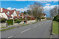
Wray Park Road
Housing in Wray Park Road, built on land occupied by a large Victorian house, Birdhurst, demolished in the mid 20th Century, the lodge of which can be seen in the background (see Image). The wall is a remnant of the original boundary wall.
Image: © Ian Capper
Taken: 12 Apr 2021
0.09 miles
7
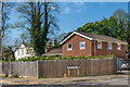
45 Wray Park Road
House on the corner of Wray Park Road and Brightlands Road, with an address in the former even though accessed off the latter. Built in the c.1970s along with nos 1 and 1a Brightlands Road, on the site of the former 45 Wray Park Road.
Image: © Ian Capper
Taken: 13 Apr 2020
0.10 miles
8
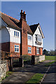
Birdhurst Lodge
Lodge to Birdhurst, a large house now demolished. The brick motif on the chimney gives a building date of 1892.
Image: © Ian Capper
Taken: 19 Mar 2011
0.11 miles
9
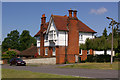
Birdhurst Lodge
Lodge to Birdhurst, a large house now demolished. A brick motif on the far side (see Image) gives a building date of 1892.
Image: © Ian Capper
Taken: 7 Jun 2008
0.11 miles
10
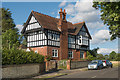
Birdhurst Lodge
Lodge to Birdhurst, a large house now demolished. The brick motif on the chimney gives a building date of 1892.
Image: © Ian Capper
Taken: 3 Aug 2014
0.11 miles