1
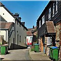
East along Lower Street Pulborough
Image: © Dave Spicer
Taken: 11 Jun 2011
0.00 miles
2
Cottages in Lower Street, Pulborough
A 15th century timber-framed Grade II listed building: http://www.britishlistedbuildings.co.uk/en-298570-73-75-and-79-lower-street-pulborough-wes
Image: © David960
Taken: 21 Apr 2014
0.02 miles
3
Lower Street - view to the west
Image: © Ian Hawfinch
Taken: 19 Apr 2021
0.02 miles
4
Pulborough Telephone Exchange
Situated in Lower Street (A283) adjacent to the Royal Mail Delivery Office, this TE serves Pulborough plus Codmore Hill, Coldwaltham, Greatham, Hardham and North Heath nearby. A Royal Mail van can be seen to the right of the photo. This TE has (01798) 87xxxx numbers and its postcode is RH20 2AZ.
Image: © David Hillas
Taken: 28 Aug 2012
0.02 miles
5
Barn House Lane
Image: © Ian Hawfinch
Taken: 19 Apr 2021
0.03 miles
6
Golden House Chinese Takeaway, Lower Street, Pulborough
One of many shops located in cottages that line Lower Street. Unfortunately the for sale sign outside suggests this one is no longer operating.
Image: © Simon Carey
Taken: 22 Dec 2006
0.03 miles
7
Lower Street, Pulborough
The village grew up around the crossing place of the old Roman road, Stane Street, over the River Arun and the road to Winchester. Where the Wealden landscape rises out of the river valley Pulborough church sits, however, the commercial centre straggles along the east-west road known as Lower Street. Many of the shops are still housed in the cottages that line the street.
Image: © Simon Carey
Taken: 23 Sep 2006
0.03 miles
8
Barn House Lane Pulborough
Barn House Lane is a footpath that leads down to flood plain below Pulborough
Image: © Dave Spicer
Taken: 11 Jun 2011
0.04 miles
9
Cottages in Lower Street, Pulborough
No. 50 (centre) is Grade II listed: http://www.britishlistedbuildings.co.uk/en-298580-50-lower-street-pulborough-west-sussex
Image: © David960
Taken: 21 Apr 2014
0.04 miles
10
Barn House Lane Pulborough
Image: © Peter Jeffery
Taken: 1 Apr 2006
0.06 miles


