
IMAGES TAKEN NEAR TO
Greyfriars Lane, PULBOROUGH, RH20 4HE
Introduction
This page details the photographs taken nearby to Greyfriars Lane, RH20 4HE by members of the Geograph project.
The Geograph project started in 2005 with the aim of publishing, organising and preserving representative images for every square kilometre of Great Britain, Ireland and the Isle of Man.

There are currently over 7.5m images from over14,400 individuals and you can help contribute to the project by visiting https://www.geograph.org.uk
Image Map
Images are licensed for reuse under creativecommons.org/licenses/by-sa/2.0
Notes
- Clicking on the map will re-center to the selected point.
- The higher the marker number, the further away the image location is from the centre of the postcode.
Image Listing (12 Images Found)
Images are licensed for reuse under creativecommons.org/licenses/by-sa/2.0
Image
Details
Distance
1
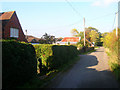
Gerston Farm, Greyfriars Lane
The farmhouse is actually the bungalow whose roof can just be seen in the middle. The buildings to the left are Gerston Cottages whilst the outbuildings further down the lane are now small industrial units.
Image: © Simon Carey
Taken: 11 Oct 2008
0.01 miles
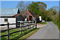
3
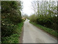
Greyfriars Lane towards Storrington
Gerston Farm is on the left.
Image: © Dave Spicer
Taken: 2 Apr 2011
0.07 miles
4
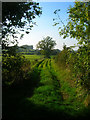
Farm Track near Gerston Farm
Viewed from Greyfriars Lane.
Image: © Simon Carey
Taken: 11 Oct 2008
0.08 miles
5
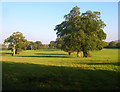
Pasture near Gerston Farm
Viewed from Greyfriars Lane the fields are to the south of the village of Storrington.
Image: © Simon Carey
Taken: 11 Oct 2008
0.10 miles
6
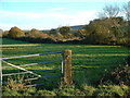
Farmland at South Storrington
Looking East across pasture
Image: © Chris Shaw
Taken: 4 Dec 2005
0.11 miles
7
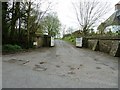
Entrance to St Joseph's Hall
It has been the residence of the Bishop of Arundel and Brighton but in 2004 it was decided by the Bishop that the property was too large for their needs and maybe sold off to the tune of £3 million. I believe this was once called Gerstons.
Image: © Dave Spicer
Taken: 2 Apr 2011
0.13 miles
8
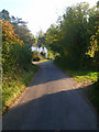
Cottage, Greyfriars Lane
At the point where the land begins to rise up the slopes of Chantry Hill.
Image: © Simon Carey
Taken: 11 Oct 2008
0.17 miles
9
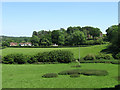
Orchard House
The house is the partially visible one to the right of the picture whilst to the left are cottages located at the entrance to that house in Greyfriars Lane. Viewed from the footpath that links Coldharbour to Kithurst Lane.
Image: © Simon Carey
Taken: 30 May 2009
0.19 miles
10
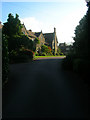
St Joseph's Abbey
Part of the building contains the original rectory built in the 17th century, however, the bulk of it was remodelled over the 19th century by lay tenants. The abbey became a convent and boarding school in 1952 until it closed its doors in 2000 and has recently been refurbished into luxury apartments.
Image: © Simon Carey
Taken: 11 Oct 2008
0.22 miles