IMAGES TAKEN NEAR TO
Foster Lane, PULBOROUGH, RH20 3PG
Introduction
This page details the photographs taken nearby to Foster Lane, RH20 3PG by members of the Geograph project.
The Geograph project started in 2005 with the aim of publishing, organising and preserving representative images for every square kilometre of Great Britain, Ireland and the Isle of Man.

There are currently over 7.5m images from over14,400 individuals and you can help contribute to the project by visiting https://www.geograph.org.uk
Image Map
Images are licensed for reuse under creativecommons.org/licenses/by-sa/2.0
Notes
- Clicking on the map will re-center to the selected point.
- The higher the marker number, the further away the image location is from the centre of the postcode.
Image Listing (69 Images Found)
Images are licensed for reuse under creativecommons.org/licenses/by-sa/2.0
Image
Details
Distance
1
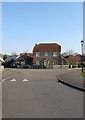
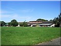
Foster Lane
An estate built on the western edge of Ashington towards the end of the 1990s. Foster Lane meanders from Church Lane to The Sands, here turning east at the junction with Willard Way.
Image: © Simon Carey
Taken: 2 Apr 2013
0.03 miles
2
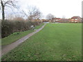
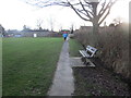
Footpath adjacent to Recreation Ground
Public footpath 2606 to The Sands.
Image: © Peter Holmes
Taken: 8 Feb 2014
0.05 miles
3
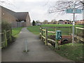
Path to Community Centre
Public footpath 2607.
Image: © Peter Holmes
Taken: 8 Feb 2014
0.06 miles
4
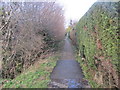
Path adjacent to ditch
Public footpath 2606 to Rectory Lane.
Image: © Peter Holmes
Taken: 8 Feb 2014
0.08 miles
6
Footpath approaching Scout Hut
Public footpath 2606 to Church Lane.
Image: © Peter Holmes
Taken: 8 Feb 2014
0.10 miles
7
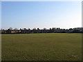
Ashington Recreation Ground
Added after the Second World War along with the estate to the north on what was once two fields called Church Field and Barn Field according to Ashington's 1847 tithe map. The hedgerow on the right hand side of the playing field once formed the parish boundary between Ashington and Washington.
Image: © Simon Carey
Taken: 2 Apr 2013
0.10 miles
8
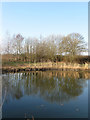
New Pond
Next to the footpath that runs between Foster Lane and Rectory Lane built as a small open space for the locals in the newly built nearby estates. According to Ashington's 1847 tithe map this was once a small field called Hog Plat.
Image: © Simon Carey
Taken: 2 Apr 2013
0.11 miles
9
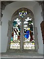
SS Peter & Paul, Ashington: stained glass window (1)
Image: © Basher Eyre
Taken: 12 Mar 2011
0.11 miles
10
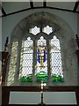
SS Peter & Paul, Ashington: stained glass window (3)
Image: © Basher Eyre
Taken: 12 Mar 2011
0.11 miles