IMAGES TAKEN NEAR TO
Rectory Close, PULBOROUGH, RH20 3LP
Introduction
This page details the photographs taken nearby to Rectory Close, RH20 3LP by members of the Geograph project.
The Geograph project started in 2005 with the aim of publishing, organising and preserving representative images for every square kilometre of Great Britain, Ireland and the Isle of Man.

There are currently over 7.5m images from over14,400 individuals and you can help contribute to the project by visiting https://www.geograph.org.uk
Image Map (Loading...)


Getting Data...Please wait
Leaflet Map data © OpenStreetMap
Images are licensed for reuse under creativecommons.org/licenses/by-sa/2.0
Notes
- Clicking on the map will re-center to the selected point.
- The higher the marker number, the further away the image location is from the centre of the postcode.
Image Listing (45 Images Found)
Images are licensed for reuse under creativecommons.org/licenses/by-sa/2.0
Image
Details
Distance
1
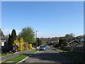
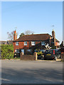
Rectory Close
A cul de sac off Rectory Lane built during the 1960s. The area of the estate was once a field called Quagmire Field, according to Ashington's 1847 tithe map, which later became an orchard towards the end of the 19th century.
Image: © Simon Carey
Taken: 28 Apr 2013
0.03 miles
2
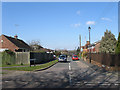
Alicia Avenue
A small cul de sac off London Road at the northern end of the village that was built during the 1930s.
Image: © Simon Carey
Taken: 2 Apr 2013
0.04 miles
3
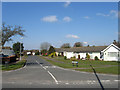
Greenacres
A small cul de sac off London Road at the northern end of the village built in the 1960s on the site of a large house and its grounds.
Image: © Simon Carey
Taken: 2 Apr 2013
0.05 miles
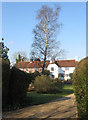
6
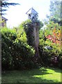
Route to Oast House Farm
Public footpath 2491 from Rectory Lane.
Image: © Peter Holmes
Taken: 8 Feb 2014
0.06 miles
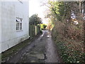
7
Sparrows Cottages
There are three cottages here that were probably built in the 18th century as they were built facing Ashington Common which was enclosed in 1816.
Image: © Simon Carey
Taken: 2 Apr 2013
0.07 miles
8
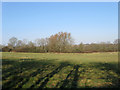
Flat Field
The name of the field according to Ashington's 1847 tithe map viewed from the footpath that links Rectory Lane to Billingshurst Road.
Image: © Simon Carey
Taken: 2 Apr 2013
0.08 miles
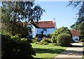
9
Cottages, Rectory Lane
Orchard Cottage to the left and Laurel Cottage to the right both of which date back to the 18th century when they were originally built on the edge of Ashington Common.
Image: © Simon Carey
Taken: 2 Apr 2013
0.08 miles
10
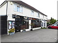
Restaurant and hairdresser's in Ashington
Another photograph is at http://www.geograph.org.uk/photo/3397786.
Image: © Shazz
Taken: 8 Sep 2015
0.09 miles