IMAGES TAKEN NEAR TO
London Road, PULBOROUGH, RH20 3DH
Introduction
This page details the photographs taken nearby to London Road, RH20 3DH by members of the Geograph project.
The Geograph project started in 2005 with the aim of publishing, organising and preserving representative images for every square kilometre of Great Britain, Ireland and the Isle of Man.

There are currently over 7.5m images from over14,400 individuals and you can help contribute to the project by visiting https://www.geograph.org.uk
Image Map
Images are licensed for reuse under creativecommons.org/licenses/by-sa/2.0
Notes
- Clicking on the map will re-center to the selected point.
- The higher the marker number, the further away the image location is from the centre of the postcode.
Image Listing (29 Images Found)
Images are licensed for reuse under creativecommons.org/licenses/by-sa/2.0
Image
Details
Distance
1
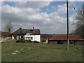
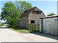
Stable Cottage
Looking at the building I think this may be a conversion from an old stable block. The cottage is the neighbour to Image
Image: © Simon Carey
Taken: 2 Apr 2013
0.01 miles
4
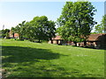
Lilly's Hill Field
The name of the field according to Washington's 1839 tithe map and one of two bordering Birch Copse which share the same name. At the top of the slope is Upper Chancton Farm.
Image: © Simon Carey
Taken: 2 Apr 2013
0.06 miles
7
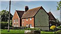
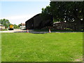
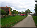
Upper Chancton Farm
The substantial farmhouse to the right dates from 1721 and is still a working farm.
Image: © Simon Carey
Taken: 2 Apr 2013
0.07 miles
9
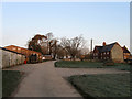
Upper Chancton Farm
An 18th century farmhouse and a number of outbuildings some of which seem to be let as small workshops. The manor of Chancton was part of Washington parish though the original manor house was believed to be on the site of Lower Chancton Farm to the south. The drive forms part of the footpath to Wiston.
Image: © Simon Carey
Taken: 2 Oct 2008
0.07 miles
10
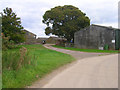
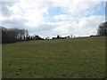
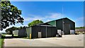
Outbuildings, Upper Chancton Farm
Taken from the driveway that is also the course of a footpath. In fact this point is a junction with a footpath heading north towards Hole Street and another going east to Wiston.
Image: © Simon Carey
Taken: 2 Oct 2008
0.08 miles