IMAGES TAKEN NEAR TO
London Road, PULBOROUGH, RH20 3AX
Introduction
This page details the photographs taken nearby to London Road, RH20 3AX by members of the Geograph project.
The Geograph project started in 2005 with the aim of publishing, organising and preserving representative images for every square kilometre of Great Britain, Ireland and the Isle of Man.

There are currently over 7.5m images from over14,400 individuals and you can help contribute to the project by visiting https://www.geograph.org.uk
Image Map
Images are licensed for reuse under creativecommons.org/licenses/by-sa/2.0
Notes
- Clicking on the map will re-center to the selected point.
- The higher the marker number, the further away the image location is from the centre of the postcode.
Image Listing (35 Images Found)
Images are licensed for reuse under creativecommons.org/licenses/by-sa/2.0
Image
Details
Distance
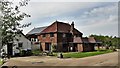
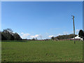
2
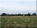
Outbuildings at East Wolves Farm
The buildings in the middle of the photograph are stables.
Image: © Ian Hawfinch
Taken: 27 Apr 2020
0.02 miles
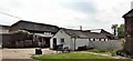
5
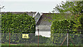
Secure area at East Wolves Farm
I assume that these buildings are connected with the farm in some way. The security and seclusion are unusual for normal farm building.
Image: © Ian Hawfinch
Taken: 27 Apr 2020
0.05 miles
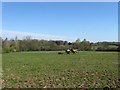
6
Carthouse Field
The name of the field according to Ashington's 1847 tithe map with the outbuildings of East Wolves Farm to the right.
Image: © Simon Carey
Taken: 28 Apr 2013
0.06 miles
7
Six Acres
The name of the field according to Washington's 1839 and Ashington's 1847 tithe maps, the old parish boundary between the two running roughly down the middle.
Image: © Simon Carey
Taken: 28 Apr 2013
0.08 miles
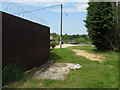
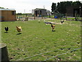
8
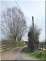
Approach road, East Wolves Farm, Ashington
The photo was taken on April 7th, in the very tardy spring of 2018. The 'soundtrack' here would include no bird-song, but plenty of cheerful noise from free-range poultry.
I find it puzzling that farm names which seem to refer to wolves are fairly common in the Weald - often taking the form 'Wolvens'.
Image: © Stefan Czapski
Taken: 7 Apr 2018
0.08 miles
9
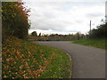
Bridleway and entrance to East Wolves Farm
Image: © Dave Spicer
Taken: 7 Nov 2010
0.08 miles
10
Barn Meadow
The name of the field according to Washington's 189 tithe map that lies to the immediate south of East Wolves Farm some of whose outbuildings have been built on the field in the last thirty years.
Image: © Simon Carey
Taken: 28 Apr 2013
0.08 miles