IMAGES TAKEN NEAR TO
Glendyne Way, EAST GRINSTEAD, RH19 4LS
Introduction
This page details the photographs taken nearby to Glendyne Way, RH19 4LS by members of the Geograph project.
The Geograph project started in 2005 with the aim of publishing, organising and preserving representative images for every square kilometre of Great Britain, Ireland and the Isle of Man.

There are currently over 7.5m images from over14,400 individuals and you can help contribute to the project by visiting https://www.geograph.org.uk
Image Map
Images are licensed for reuse under creativecommons.org/licenses/by-sa/2.0
Notes
- Clicking on the map will re-center to the selected point.
- The higher the marker number, the further away the image location is from the centre of the postcode.
Image Listing (72 Images Found)
Images are licensed for reuse under creativecommons.org/licenses/by-sa/2.0
Image
Details
Distance
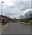
4
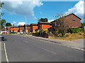
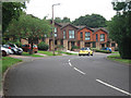
Herontye Drive, East Grinstead
Houses on Herontye Drive in East Grinstead.
Image: © Malc McDonald
Taken: 14 Jul 2018
0.07 miles
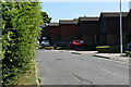
5
Herontye Drive, East Grinstead
Main access route for the Herontye estate built in the late 1970s. The road runs between Lewes Road, the A22, and a junction with Ship Street and Dunnings Road. This part of the road follows the old alignment of the drive to Herontye House.
Image: © Simon Carey
Taken: 7 Apr 2021
0.08 miles
6
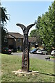
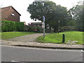
National Cycleroute Milepost, Herontye Drive
Image: © N Chadwick
Taken: 31 Jul 2020
0.08 miles
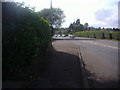
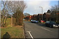
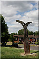
8
Forest Way, East Grinstead
Forest Way crossing Herontye Drive in East Grinstead.
To the left of the image is a National Cycle Network Millennium signpost. Forest Way forms part of National Cycle Network route 21.
Image: © Malc McDonald
Taken: 14 Jul 2018
0.08 miles
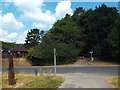
9
Forest Way crossing Herontye Drive
Forest Way is 10 mile path running from East Grinstead to Groombridge over the dismantled rail line and part of Cycle Route 21.
Image: © Dave Spicer
Taken: 24 Oct 2012
0.08 miles
10
Forest Way, East Grinstead
The long distance Route 21, which heads east, from East Grinstead to Groombridge. Easy walking and cycling, with a good surface, on a former railway line. The route marker stands beside a road crossing point, on the outskirts of East Grinstead.
Image: © Peter Trimming
Taken: 25 Jun 2014
0.09 miles