IMAGES TAKEN NEAR TO
Maypole Road, EAST GRINSTEAD, RH19 3RB
Introduction
This page details the photographs taken nearby to Maypole Road, RH19 3RB by members of the Geograph project.
The Geograph project started in 2005 with the aim of publishing, organising and preserving representative images for every square kilometre of Great Britain, Ireland and the Isle of Man.

There are currently over 7.5m images from over14,400 individuals and you can help contribute to the project by visiting https://www.geograph.org.uk
Image Map
Images are licensed for reuse under creativecommons.org/licenses/by-sa/2.0
Notes
- Clicking on the map will re-center to the selected point.
- The higher the marker number, the further away the image location is from the centre of the postcode.
Image Listing (43 Images Found)
Images are licensed for reuse under creativecommons.org/licenses/by-sa/2.0
Image
Details
Distance
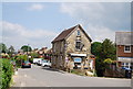
3

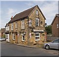
Allan Martin Meats
"Award winning butchers".
Image: © Robin Webster
Taken: 17 Jan 2010
0.07 miles
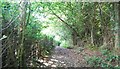
8
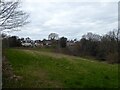
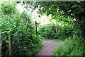
The Meadow
The name of the field according to East Grinstead's 1841 tithe map located to the north of Ashurstwood Primary School with the rear of the houses in Phoenix Lane in view.
Image: © Simon Carey
Taken: 7 Apr 2021
0.11 miles