
IMAGES TAKEN NEAR TO
Furnace Farm Road, EAST GRINSTEAD, RH19 2QD
Introduction
This page details the photographs taken nearby to Furnace Farm Road, RH19 2QD by members of the Geograph project.
The Geograph project started in 2005 with the aim of publishing, organising and preserving representative images for every square kilometre of Great Britain, Ireland and the Isle of Man.

There are currently over 7.5m images from over14,400 individuals and you can help contribute to the project by visiting https://www.geograph.org.uk
Image Map
Images are licensed for reuse under creativecommons.org/licenses/by-sa/2.0
Notes
- Clicking on the map will re-center to the selected point.
- The higher the marker number, the further away the image location is from the centre of the postcode.
Image Listing (14 Images Found)
Images are licensed for reuse under creativecommons.org/licenses/by-sa/2.0
Image
Details
Distance
1
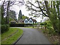
Furnace, Furnace Farm Road, Furnace Wood
Originally built in the 1760s for workers of the nearby Warren Furnace that had been revived after a century of disuse to cast cannons. It was originally two cottages but has since been combined into a single dwelling.
Image: © Simon Carey
Taken: 5 May 2024
0.01 miles
2
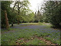
Bluebells, Furnace Wood
A small tract of land bounded by Furnace Farm Road tot he south and Lake View Road to the west is carpeted with bluebells. The private estate of Furnace Wood was built in the wood of the same name.
Image: © Simon Carey
Taken: 5 May 2024
0.04 miles
3

Site of Warren Furnace
Originally opened in the 1550s the furnace operated over two distinct periods; up until 1627, then reopened in 1758 until its final closure in 1774. On the right is the 5 metre pond bay, see Image, which separates it from Image
Image: © Simon Carey
Taken: 5 May 2024
0.07 miles
4
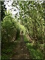
Pond Bay, Warren Furnace
The bay carries Worth 49 public footpath along the northern side of Image The dam itself is about 5 metres in height with the working area to the north, see Image The current spillway, see Image, was restored in 1919 and is located at the western end. Warren Furnace operated over two periods; from the 1550s to 1627 and then reopened from 1758 to 1774. The site was converted into a corn mill which was in use in the first half of the 19th century.
Image: © Simon Carey
Taken: 5 May 2024
0.08 miles
5
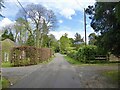
Lake View Road, Furnace Wood
A private road and also Worth 46 Public Footpath that links Furnace Farm Road to Copthorne Road, the A264. The public footpath ends at the Surrey border. Furnace Wood was developed from the 1920s onwards and is now a private estate of around 90 dwellings.
Image: © Simon Carey
Taken: 5 May 2024
0.09 miles
6

Felbridge Water
The view from above as the stream descends the spillway from Image
Image: © Simon Carey
Taken: 5 May 2024
0.09 miles
7
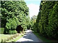
Lake View Road, Furnace Green
High Leylandii and large house plots along this road
Image: © Nigel Freeman
Taken: 25 Aug 2006
0.09 miles
8
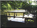
Furnace Pond
Now a private fishing lake, once a hammer pond for the forge.
Image: © Nigel Freeman
Taken: 25 Aug 2006
0.11 miles
9

Furnace Wood
A small section of the wood on the western bank of Felbridge Water festooned with bluebells.
Image: © Simon Carey
Taken: 5 May 2024
0.11 miles
10
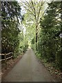
Felcourt Road, Furnace Wood
A private road linking Furnace Farm Road to Lake View Road that was developed from the 1920s onwards within what was once Furnace Wood.
Image: © Simon Carey
Taken: 5 May 2024
0.14 miles