IMAGES TAKEN NEAR TO
Hundred Acre Lane, HAYWARDS HEATH, RH17 7RU
Introduction
This page details the photographs taken nearby to Hundred Acre Lane, RH17 7RU by members of the Geograph project.
The Geograph project started in 2005 with the aim of publishing, organising and preserving representative images for every square kilometre of Great Britain, Ireland and the Isle of Man.

There are currently over 7.5m images from over14,400 individuals and you can help contribute to the project by visiting https://www.geograph.org.uk
Image Map
Images are licensed for reuse under creativecommons.org/licenses/by-sa/2.0
Notes
- Clicking on the map will re-center to the selected point.
- The higher the marker number, the further away the image location is from the centre of the postcode.
Image Listing (10 Images Found)
Images are licensed for reuse under creativecommons.org/licenses/by-sa/2.0
Image
Details
Distance
1
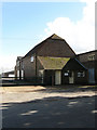
Park Farm Barn
Former barn now converted to either an office or small unit serving a number of other small business units south of Park Farmhouse.
Image: © Simon Carey
Taken: 10 Oct 2009
0.01 miles
2
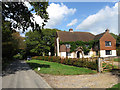
Park Farmhouse
Originally known as Hundredacre Farm the name changed sometime between 1911 and 1936 to its current one. Hundred Acre Lane is on the left.
Image: © Simon Carey
Taken: 10 Oct 2009
0.05 miles
3
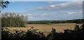
Crop field off Hundred Acre Lane
Image: © Oast House Archive
Taken: 17 Oct 2010
0.12 miles
4
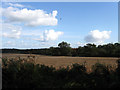
Site of Hundred Acre Wood
Marked on the 1843 tithe map as woodland by the time of the OS surveys of the late 1870s this had been grubbed up leaving a small area of wood north of Park Farm still bearing that name. Viewed from Hundred Acre Lane the southern end of the field marks the parish boundary between Wivelsfield and Streat.
Image: © Simon Carey
Taken: 10 Oct 2009
0.13 miles
5
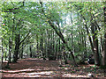
Yewtree Wood
Parcel of private woodland located between Hundred Acre Lane and Bushycommon Wood. Yew trees don't seem to be around here though a dumped jeep is to the right.
Image: © Simon Carey
Taken: 10 Oct 2009
0.15 miles
6
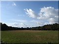
Bottom Field
The name of the field according to the 1842 tithe map and once part of Middleton Common that was enclosed in the early 17th century. Viewed from Hundred Acre Lane with Yew Tree Wood and Bushycommon Wood providing the northern boundary of the field.
Image: © Simon Carey
Taken: 10 Oct 2009
0.16 miles
7
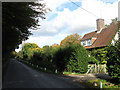
Red Acres, Hundred Acre Lane
Yewtree Wood is on the left hand side of the land and marks the parish boundary between Westmeston and Wivelsfield.
Image: © Simon Carey
Taken: 10 Oct 2009
0.17 miles
8
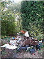
Fly Tipping, Yewtree Wood
Seems to be an even larger amount of dumped material further down the track. There are now metal bollards in place next to the access point on Hundred Acre Lane as well as notices by Lewes District Council of an impending removal.
Image: © Simon Carey
Taken: 10 Oct 2009
0.21 miles
9
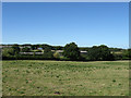
Middle Field
The name of the field according to the 1838 tithe map and formerly part of Middleton Common enclosed in the mid 17th century. The buildings in the distance form part of North America Farm.
Image: © Simon Carey
Taken: 31 Aug 2009
0.22 miles