1
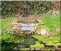
Ludwell, Wateringbury Hill, Horsted Keynes
Dating from at least the 17th century and located to the immediate south of Ludwell Spring.
Image: © Simon Carey
Taken: 9 Aug 2020
0.01 miles
2
Ludwell Spring, Horsted Keynes
Located on the north side of the road, at Waterbury Hill, on the western side of Horsted Keynes.
Image: © Peter Trimming
Taken: 2 Feb 2014
0.03 miles
3
Ludwell Spring, Horsted Keynes
Located on the north side of the road, at Waterbury Hill, on the western side of Horsted Keynes.
Image: © Peter Trimming
Taken: 2 Feb 2014
0.03 miles
4
Old Direction Sign - Signpost by Ludwell, Horsted Keynes
Black iron cap finial - 4 arms; East Sussex wood by the UC road, in parish of Horsted Keynes (Mid Sussex District), Ludwell, Horsted Keynes, junction of Keysford Lane, Waterbury Lane, Station Road and Sugar Lane.
To be surveyed
Milestone Society National ID: SX_TQ3728
Image: © Milestone Society
Taken: Unknown
0.03 miles
5
The village pump at Ludwell
This is apparently the original pump, found and restored by local volunteers in 1990. For context and history, see
Image
Image: © Stephen Craven
Taken: 1 Apr 2013
0.03 miles
6
Road junction at Ludwell
A four-way junction. Foreground: Station Road towards Horsted Keynes village. Right: Waterbury Hill towards East Grinstead. left: Sugar Lane towards Lewes. Straight on (actually just out of shot to the left): Keysford lane towards Haywards Heath.
Image: © Stephen Craven
Taken: 1 Apr 2013
0.03 miles
7
The Martindale Centre, Horsted Keynes
The village hall is named after the female minister of the Congregational church in the village, whose idea it was. It opened in 1907 and at various times has functioned as a church, meeting hall, scout hut, doctor's surgery, play centre as well as a meeting place. (information from the village website: http://www.horstedkeynes.com/martindalearticle.html )
Image: © Stephen Craven
Taken: 1 Apr 2013
0.03 miles
8
Ludwell pool
The name Ludwell is given to this natural spring to the west of Horsted Keynes village, on the brow of the hill. According to the information board on site, it is a chalybeate water like that at Tunbridge Wells, but this spring never became a spa. The name Ludwell is probably a corruption of Lord's Well: the legend is that people fleeing the great Plague of London in 1666 stopped here to wash the plague from their bodies. It was restored by local volunteers in 1990. The flow rate has been measured at 1.0 to 1.75 litres/second.
Image: © Stephen Craven
Taken: 1 Apr 2013
0.04 miles
9
Ludwell Spring, Horsted Keynes - detail
The spring and pump, with inscription "Recorded by Revd. Giles Moore 1668, restored by local volunteers 1991".
Image: © Robin Webster
Taken: 15 Mar 2010
0.04 miles
10
Drinking trough at Ludwell
The trough has been formed in brick on the outlet of Ludwell Pool
Image
Image: © Stephen Craven
Taken: 1 Apr 2013
0.04 miles


