
IMAGES TAKEN NEAR TO
Buckle Lane, HAYWARDS HEATH, RH17 7DW
Introduction
This page details the photographs taken nearby to Buckle Lane, RH17 7DW by members of the Geograph project.
The Geograph project started in 2005 with the aim of publishing, organising and preserving representative images for every square kilometre of Great Britain, Ireland and the Isle of Man.

There are currently over 7.5m images from over14,400 individuals and you can help contribute to the project by visiting https://www.geograph.org.uk
Image Map
Images are licensed for reuse under creativecommons.org/licenses/by-sa/2.0
Notes
- Clicking on the map will re-center to the selected point.
- The higher the marker number, the further away the image location is from the centre of the postcode.
Image Listing (65 Images Found)
Images are licensed for reuse under creativecommons.org/licenses/by-sa/2.0
Image
Details
Distance
1
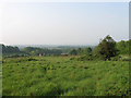
Twelve Acres
The name of the field according to Wivelsfield's 1843 tithe map viewed from Southdowns Park. The buildings below belong to Hospital Farm whilst the South Downs are just visible through the haze on the horizon. This field is earmarked for development and will have housing built upon as the Haywards Heath relief road is constructed to the south.
Image: © Simon Carey
Taken: 30 Apr 2011
0.02 miles
2

Old Track to Hospital Farm
The hospital was constructed on land once farmed by Hurst Farm and in time the former came to own the latter in order to provide both provisions and work for the patients, all part of the Victorian drive for self sufficiency. This remained the case until 1970 when the law was changed forbidding hospitals using patients for employment and the farm was eventually sold in 1978. The track is private and no longer seems well used.
Image: © Simon Carey
Taken: 30 Apr 2011
0.03 miles
3
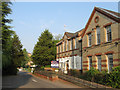
Martlet Lodge
Originally part of St Francis Hospital and used as an isolation unit. Currently awaiting redevelopment.
Image: © Simon Carey
Taken: 30 Apr 2011
0.04 miles
4
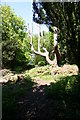
Sussex County Lunatic Asylum Burial Ground
This rather gaunt tree marks the centre of the Burial Ground used by the Lunatic Asylum, later to become St. Francis Hospital. The Burial ground was divided into four quadrants by a series of paths. Records of the burials are kept at the East Sussex Records Office.
Image: © Peter Jeffery
Taken: 1 Apr 2008
0.06 miles
5
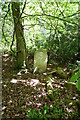
Sussex County Lunatic Asylum Burial Ground
The Asylum burial ground is now overgrown and derelict, it was full when it closed in 1891,but according to the plans held by the East Sussex Records Office, only four of the graves had a headstone. This photo shows one of the headstones still in situ.
Image: © Peter Jeffery
Taken: 1 Apr 2008
0.06 miles
6
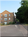
Assisi Heights, Southdowns Park
The far eastern end of the former hospital complex that has now been converted into residential use.
Image: © Simon Carey
Taken: 30 Apr 2011
0.08 miles
7
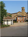
Park East, Southdowns Park
In the foreground is a former airing shelter whilst to the rear is the former east wing which was the male section of the hospital and the sunken building in between was one of a number added during an extension in 1873. All are now converted to residences.
Image: © Simon Carey
Taken: 30 Apr 2011
0.08 miles
8
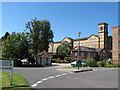
Southdowns Park
A former mental hospital now converted to private residential housing.
Image: © Dave Spicer
Taken: 7 Sep 2012
0.10 miles
9

Princess Royal Hospital, Haywards Heath
Glass curtain walling reflecting the low sun.
Image: © Oast House Archive
Taken: 20 Dec 2009
0.11 miles
10
St Francis Sport and Social Club
Founded during the 1960s and still going strong today having outlived the hospital it was built to serve though I believe it still acts as a social club for the members of Princess Royal Hospital. The sports club runs a Sussex County football team, cricket, hockey and stoolball teams as well as owning Image
Image: © Simon Carey
Taken: 30 Apr 2011
0.13 miles