Park East, Southdowns Park
Introduction
The photograph on this page of Park East, Southdowns Park by Simon Carey as part of the Geograph project.
The Geograph project started in 2005 with the aim of publishing, organising and preserving representative images for every square kilometre of Great Britain, Ireland and the Isle of Man.

There are currently over 7.5m images from over 14,400 individuals and you can help contribute to the project by visiting https://www.geograph.org.uk
Park East, Southdowns Park
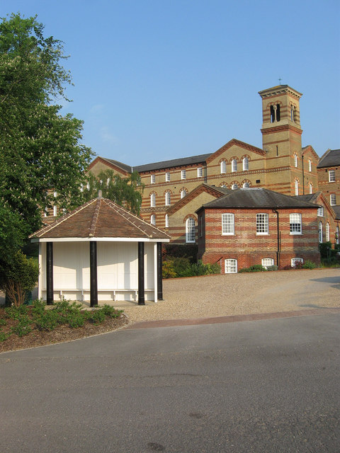
Image: © Simon Carey Taken: 30 Apr 2011
In the foreground is a former airing shelter whilst to the rear is the former east wing which was the male section of the hospital and the sunken building in between was one of a number added during an extension in 1873. All are now converted to residences.
Images are licensed for reuse under creativecommons.org/licenses/by-sa/2.0
Image Location
Latitude
50.989602
Longitude
-0.095259