IMAGES TAKEN NEAR TO
Cuckfield Lane, HAYWARDS HEATH, RH17 5SN
Introduction
This page details the photographs taken nearby to Cuckfield Lane, RH17 5SN by members of the Geograph project.
The Geograph project started in 2005 with the aim of publishing, organising and preserving representative images for every square kilometre of Great Britain, Ireland and the Isle of Man.

There are currently over 7.5m images from over14,400 individuals and you can help contribute to the project by visiting https://www.geograph.org.uk
Image Map
Images are licensed for reuse under creativecommons.org/licenses/by-sa/2.0
Notes
- Clicking on the map will re-center to the selected point.
- The higher the marker number, the further away the image location is from the centre of the postcode.
Image Listing (21 Images Found)
Images are licensed for reuse under creativecommons.org/licenses/by-sa/2.0
Image
Details
Distance
1
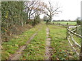
House on Cuckfield Lane seen from footpath to the south
Image: © Shazz
Taken: 23 Nov 2016
0.01 miles
2
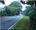
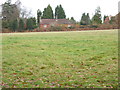
B2115 (Cuckfield Lane) West of Pitts Head Crossroads, West Sussex
View looking W along Cuckfield Lane, towards Warninglid. This stretch of the road is approx quarter of a mile W of Pitts Head Crossroads (A23 junction).
Image: © Pete Chapman
Taken: 8 Oct 2005
0.02 miles
3
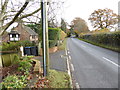
Cuckfield Lane looking east from edge of woodland
Image: © Shazz
Taken: 23 Nov 2016
0.03 miles
4
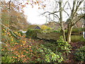
Looking north east from edge of woodland on Cuckfield Lane
Image: © Shazz
Taken: 23 Nov 2016
0.07 miles
5
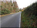
Looking east on Cuckfield Lane from beneath power lines
Image: © Shazz
Taken: 23 Nov 2016
0.07 miles
6
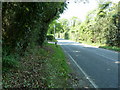
B2115 Cuckfield Lane
On the outskirts of Warninglid.
Image: © Dave Spicer
Taken: 23 Apr 2011
0.08 miles
7
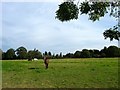
Birch Field
The name of the field according to Slaugham's 1842 tithe map that is bounded by Image to the south, Image to the west, Image to the east and Cuckfield Lane, the B2115, to the north, beyond which is Woodhill, the house in view.
Image: © Simon Carey
Taken: 25 Sep 2014
0.09 miles
8
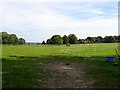
Pear Tree Plat/Wood Field
The name of the fields according to Slaugham's 1842 tithe map that have been merged to form a larger unit. Pear Tree Plat was in the foreground adjacent to the footpath to the A23, whilst Wood Field was to the north next to Cuckfield Lane, the B2115. The field is bounded by Image to the south and Image to the east. The buildings in view are Fridays Farm to the left and Woodhill to the right.
Image: © Simon Carey
Taken: 25 Sep 2014
0.12 miles
9
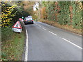
Looking west on Cuckfield Lane from beneath power lines
Image: © Shazz
Taken: 23 Nov 2016
0.12 miles