
IMAGES TAKEN NEAR TO
Twineham Lane, HAYWARDS HEATH, RH17 5NP
Introduction
This page details the photographs taken nearby to Twineham Lane, RH17 5NP by members of the Geograph project.
The Geograph project started in 2005 with the aim of publishing, organising and preserving representative images for every square kilometre of Great Britain, Ireland and the Isle of Man.

There are currently over 7.5m images from over14,400 individuals and you can help contribute to the project by visiting https://www.geograph.org.uk
Image Map
Images are licensed for reuse under creativecommons.org/licenses/by-sa/2.0
Notes
- Clicking on the map will re-center to the selected point.
- The higher the marker number, the further away the image location is from the centre of the postcode.
Image Listing (83 Images Found)
Images are licensed for reuse under creativecommons.org/licenses/by-sa/2.0
Image
Details
Distance
1
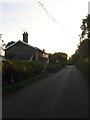
Cottages, Twineham Lane, Twineham
The southern most dwellings in the small village are Twineham Place cottage and Walnuts respectively. Both seem to date from the mid 19th century. They are located to the immediate south of Image
Image: © Simon Carey
Taken: 21 Aug 2014
0.00 miles
2
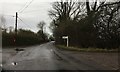
Twineham Lane
Twineham Lane at the junction with the lane leading to the Church and the School.
Image: © Chris Thomas-Atkin
Taken: 31 Dec 2017
0.04 miles
3
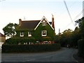
Red Gables, Twineham Lane, Twineham
Located on the junction with Church Lane, the house dates from the late 19th century and was originally the village post office and shop.
Image: © Simon Carey
Taken: 21 Aug 2014
0.04 miles
4
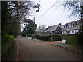
Church Lane
Small dead end lane off Twineham Lane that leads to a few houses, the school and the church. Footpath continue beyond the church to Twineham Place and Twineham Grange.
Image: © Simon Carey
Taken: 4 Jan 2009
0.04 miles
5
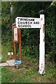
Direction Sign - Signpost by Twineham Lane, Twineham
Black iron cap finial - 1 arm; East Sussex wood by the UC road, in parish of Twineham (Mid Sussex District), Twineham Lane, on verge opposite lane leading to church and school (by parish notice board).
Surveyed
Milestone Society National ID: SX_TQ2519
Image: © Milestone Society
Taken: Unknown
0.05 miles
6
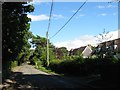
Swedish Houses, Church Lane, Twineham
A pair of semi detached houses on the southern side of Church Lane. They were built in 1946 by Italian POWs with material donated from the Swedish government, hence the name.
Image: © Simon Carey
Taken: 17 Aug 2014
0.06 miles
7
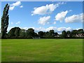
Twineham Recreation Ground
Located to the south of Church Lane and west of Twineham Lane and dates from the postwar era. Originally both the playing field and Image in view to the north were part of a field called Ganders Croft, according to Twineham's 1837 tithe map. The ground is home to Twineham & Wineham Cricket Club which has been in existence since 1893.
Image: © Simon Carey
Taken: 17 Aug 2014
0.06 miles
8
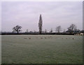
Twineham Recreation Ground
The cricket pitch seems to have been invaded by an army of moles. The cloud cover is now complete meaning the frost will remain covering the ground for the rest of the day.
Image: © Simon Carey
Taken: 4 Jan 2009
0.07 miles
9
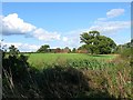
Park Field
The name of the field according to Twineham's 1837 tithe map that lies to the east of Twineham Lane and north of Image The buildings in the distance belong to Park Farm.
Image: © Simon Carey
Taken: 17 Aug 2014
0.07 miles
10
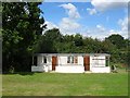
Cricket Pavilion, Twineham Recreation Ground
Located in the north west corner and judging by the size a bit rudimentary.
All the area between Henfield and the A23 is currently under threat of a proposed private development to build a new garden town the size of Burgess Hill.
Image: © Simon Carey
Taken: 21 Aug 2014
0.07 miles