IMAGES TAKEN NEAR TO
Broad Street, HAYWARDS HEATH, RH17 5LL
Introduction
This page details the photographs taken nearby to Broad Street, RH17 5LL by members of the Geograph project.
The Geograph project started in 2005 with the aim of publishing, organising and preserving representative images for every square kilometre of Great Britain, Ireland and the Isle of Man.

There are currently over 7.5m images from over14,400 individuals and you can help contribute to the project by visiting https://www.geograph.org.uk
Image Map
Images are licensed for reuse under creativecommons.org/licenses/by-sa/2.0
Notes
- Clicking on the map will re-center to the selected point.
- The higher the marker number, the further away the image location is from the centre of the postcode.
Image Listing (245 Images Found)
Images are licensed for reuse under creativecommons.org/licenses/by-sa/2.0
Image
Details
Distance
1
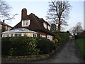
Mytten Lodge, Broad Street, Cuckfield
Originally the lodge for Mytten, a large Victorian house. Both lodge and house were not marked on Cuckfield's 1843 tithe map but are on the 1874 OS map giving some idea of construction. The drive to the house remained in use until the 1970s when Image was developed and now serves a couple of smaller dwellings, Mytten Cedars and Mytten Magnolia.
Image: © Simon Carey
Taken: 20 Dec 2014
0.05 miles
2
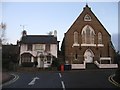
Former Congregational Chapel, Broad Street, Cuckfield
Established in 1820 as the Providence Congregational Chapel it was rebuilt in 1869 and continued to serve the local community until its closure in 1979. Since then it has been converted into offices. The white building on the left is Gardenia Tea House and both are being viewed from the entrance to the village's car park.
Image: © Simon Carey
Taken: 29 Nov 2014
0.06 miles
3
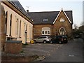
Chapel End, Broad Street, Cuckfield
Located behind the Image and originally built as a British School, the nonconformist equivalent of a National School, in 1869 which had previously been a day school in the chapel building and continued operating until closure in 1907. It is marked as a Sunday school on all OS maps up to 1970 and was probably used as the church hall as well. It was sold in the 1980s and converted into a residence which it remains today.
Image: © Simon Carey
Taken: 20 Dec 2014
0.06 miles
4

The Old Vicarage, Cuckfield
Church records show that "the Charles Reverend Ashburnham began building the new Vicarage House in October 1780" apparently it took just short of a year to build. It was extended in 1818 and again in 1850.
Image: © Kevin Gordon
Taken: 18 Oct 2008
0.07 miles
5
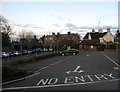
Broad Street Car Park, Cuckfield
The section by the wall to the left is free 24 hour parking whilst the rest is short stay and requires a purchased disc from local shops. Not surprisingly the section by the wall fills up pretty rapidly wit this view taken just before 8am. The car park also contains the local public convenience. Originally part of the gardens of the Old Vicarage. The buildings beyond face onto the High Street.
Image: © Simon Carey
Taken: 20 Dec 2014
0.07 miles
6
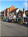
2-5, High Street, Cuckfield
Working from right to left, number 2, known as Picknells, dates from the 17th and was extended to include a shop front in the 19th. Number 3, Teinter Cottage, dates from the 18th century and was a doctors surgery from 1974-91 and later a dentist. Numbers 4-5 are three storied town houses, sometimes referred to as Teinter Cottages and were built in the early 19th century and very similar to contemporary designs constructed in Brighton.
Image: © Simon Carey
Taken: 20 Dec 2014
0.08 miles
7
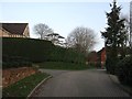
Mytten Bank, Cuckfield
Small cul de sac containing four dwellings off Broad Street built in the 1990s in the former grounds of Mytten House which was once a field, according to Cuckfield's 1843 tithe map, called Mittens Field.
Image: © Simon Carey
Taken: 20 Dec 2014
0.08 miles
8
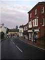
Lorimer House, Broad Street, Cuckfield
Built with the lower floor as a shop around 1900, see http://cuckfieldmuseum.org/history for an early image. Beyond is the junction with High Street.
Image: © Simon Carey
Taken: 29 Nov 2014
0.09 miles