
IMAGES TAKEN NEAR TO
South Street, HAYWARDS HEATH, RH17 5LB
Introduction
This page details the photographs taken nearby to South Street, RH17 5LB by members of the Geograph project.
The Geograph project started in 2005 with the aim of publishing, organising and preserving representative images for every square kilometre of Great Britain, Ireland and the Isle of Man.

There are currently over 7.5m images from over14,400 individuals and you can help contribute to the project by visiting https://www.geograph.org.uk
Image Map
Images are licensed for reuse under creativecommons.org/licenses/by-sa/2.0
Notes
- Clicking on the map will re-center to the selected point.
- The higher the marker number, the further away the image location is from the centre of the postcode.
Image Listing (242 Images Found)
Images are licensed for reuse under creativecommons.org/licenses/by-sa/2.0
Image
Details
Distance
1
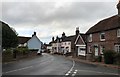
Cuckfield South Street
At the junction with Ockenden Lane looking southwards.
Image: © Chris Thomas-Atkin
Taken: 28 Oct 2018
0.01 miles
2
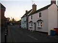
Somners and The Friary, South Street, Cuckfield
The Friary in the foreground dates back to at least the 15th century and was originally a timber framed building that was encased in brick in 1700 and remodelled and over the 17th and 18th centuries with the front extended in the 19th. Its neighbour painted light blue is Somners dates from at least the 19th century and may be older.
Image: © Simon Carey
Taken: 13 Dec 2014
0.01 miles
3
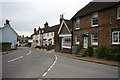
South Street, Cuckfield
Taken from its junction with Ockenden Lane (right).
Image: © David Kemp
Taken: 21 May 2013
0.01 miles
5
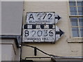
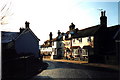
Pre-Worboys direction signs, Cuckfield High Street
Thanks to Dave Spicer for finding these, I'd never have known about them otherwise.
Image: © David Howard
Taken: 7 Apr 2013
0.01 miles
6
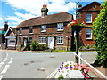
Cottage on junction of South Street and Ockenden Lane
The building on the right is a former drill hall. The trough is also seen at http://www.geograph.org.uk/photo/2569559.
Image: © Shazz
Taken: 14 Jul 2014
0.02 miles
7

22-23 South Street, Cuckfield
Number 22 has the date 1722 above the door though the building is believed to be much older dating back to the 16th century. To the right of the cottages is the junction with Ockenden Lane before which is a 19th century water trough which occupied the site of the former village stocks.
Image: © Simon Carey
Taken: 29 Nov 2014
0.02 miles
8
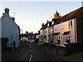
South Street, Cuckfield
Viewed from the junction with Ockenden Lane. The former A272 performs two dog legs as it travels through this part of the town believed to have been the result of infilling of the old medieval market place. The road has been the B2036 since the opening of the bypass in 1988.
Image: © Simon Carey
Taken: 28 Oct 2014
0.02 miles
9
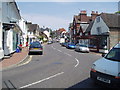
Cuckfield High Street
Cuckfield is now by-passed so this bend is not as busy as it once was. In the days of coaching, this village was an important stopping place on the route from London to Brighton.
Image: © Nigel Freeman
Taken: 27 Jun 2005
0.02 miles
10
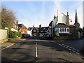
South Street, Cuckfield
The view when entering the settlement from the south with the junction of Newbury Lane to the right. Chainwalk House lies on the corner whilst beyond at the first turning of the meandering street is the White Hart.
Image: © Simon Carey
Taken: 29 Nov 2014
0.02 miles