IMAGES TAKEN NEAR TO
Brook Street, HAYWARDS HEATH, RH17 5JL
Introduction
This page details the photographs taken nearby to Brook Street, RH17 5JL by members of the Geograph project.
The Geograph project started in 2005 with the aim of publishing, organising and preserving representative images for every square kilometre of Great Britain, Ireland and the Isle of Man.

There are currently over 7.5m images from over14,400 individuals and you can help contribute to the project by visiting https://www.geograph.org.uk
Image Map
Images are licensed for reuse under creativecommons.org/licenses/by-sa/2.0
Notes
- Clicking on the map will re-center to the selected point.
- The higher the marker number, the further away the image location is from the centre of the postcode.
Image Listing (50 Images Found)
Images are licensed for reuse under creativecommons.org/licenses/by-sa/2.0
Image
Details
Distance
1
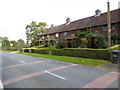
Terrace of cottages on Brook Street
See also http://www.geograph.org.uk/photo/4290790.
Image: © Shazz
Taken: 12 Oct 2016
0.01 miles
2
Diamond Cottages, Brook Street, Brook Street
A row of four mid Victorian cottage that are located on the eastern side of the B2036 called Brook Street at the northern end of the settlement of the same name.
Image: © Simon Carey
Taken: 20 Dec 2014
0.01 miles
4
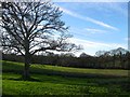
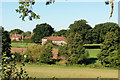
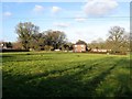
Norris Mead
The name of the field according to Cuckfield's 1843 tithe map that has been merged with Image to the north to form a larger unit. The field just visible through the trees to the right is Image
Image: © Simon Carey
Taken: 20 Dec 2014
0.06 miles
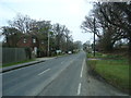
5
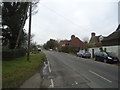
Houses, Brook Street
The houses on the left are on the far side of Brook Street, on the right set well back on the near side.
Image: © Robin Webster
Taken: 26 Sep 2018
0.07 miles
6
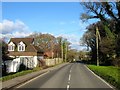
The Forge, Brook Street, Brook Street
Dating from the 18th century with Victorian additions, possibly on or near the site of the former village smithy.
Image: © Simon Carey
Taken: 20 Dec 2014
0.07 miles
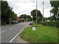
9
Pond Meadow
The name of the field according to Cuckfield's 1843 tithe map that has been extended to include Kiln Plat to the east whilst losing part of its area to Strood Cottages. To the left is Image whilst the titular pond lies to the north and was once part of a tan yard.
Image: © Simon Carey
Taken: 24 Jan 2015
0.09 miles
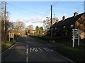
10
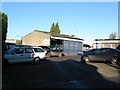
Brook Street Garage, Spark's Lane, Brook Street
One of two garages on Spark's Lane, see Image, and the larger of the two. The buildings were not marked on a 1938 OS map but do exist by the time of a 1946 aerial photograph.
Image: © Simon Carey
Taken: 6 Dec 2014
0.09 miles