
IMAGES TAKEN NEAR TO
Ardingly Road, HAYWARDS HEATH, RH17 5HD
Introduction
This page details the photographs taken nearby to Ardingly Road, RH17 5HD by members of the Geograph project.
The Geograph project started in 2005 with the aim of publishing, organising and preserving representative images for every square kilometre of Great Britain, Ireland and the Isle of Man.

There are currently over 7.5m images from over14,400 individuals and you can help contribute to the project by visiting https://www.geograph.org.uk
Image Map
Images are licensed for reuse under creativecommons.org/licenses/by-sa/2.0
Notes
- Clicking on the map will re-center to the selected point.
- The higher the marker number, the further away the image location is from the centre of the postcode.
Image Listing (70 Images Found)
Images are licensed for reuse under creativecommons.org/licenses/by-sa/2.0
Image
Details
Distance
1
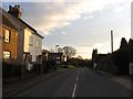
Myrtle Cottages, Ardingly Road, Cuckfield
Built in the late Victorian period with the entrance to Bylanes Close visible beyond.
Image: © Simon Carey
Taken: 20 Dec 2014
0.01 miles
2
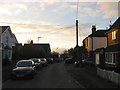
Brainsmead, Cuckfield
The road was laid out in the late Victorian period with Fern Cottages to the right and Provident Cottages out of shot to the left constructed at the same time. After that development was slow with this section between brains mead Close and Ardingly Road not completed until the 1970s. Called Brainsmead Road on the 1937 OS map with the road part dropped by the 1956 edition.
Image: © Simon Carey
Taken: 20 Dec 2014
0.03 miles
3
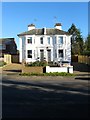
Pelham and Richmond House, London Road, Cuckfield
A semi-detached mid Victorian building on the B2036. Pelham is on the left and Richmond House to the right.
Image: © Simon Carey
Taken: 6 Dec 2014
0.06 miles
4
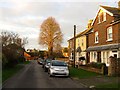
Brainsmead Close (2), Cuckfield
The older section of the close, see Image, that lies between Brainsmead and London Road. Number 2, the yellow faced cottage, was built in the late Victorian period with the others 1, 3 and 4 arriving between 1897 and 1911. At the end of the road is Image
Image: © Simon Carey
Taken: 20 Dec 2014
0.07 miles
5
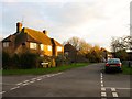
Brainsmead Close (1), Cuckfield
This part of the road lies to the east of Brainsmead and is clearly laid out on both the 1937 OS map and a 1947 aerial photograph. However, the houses were not added until after the latter first appearing on the 1956 OS edition. See also Image
Image: © Simon Carey
Taken: 20 Dec 2014
0.07 miles
6
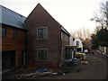
New Development, London Road, Cuckfield
A small cul de sac is currently being built on a small parcel of land off the B2036.
Image: © Simon Carey
Taken: 6 Dec 2014
0.07 miles
7
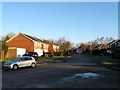
Bylanes Close, Cuckfield
Part of a small estate built in the 1970s which also contains Image and Image on former fields called Pit Meadow and Great Meadow according to Cuckfield's 1843 tithe map. Another new development Image is being built to the north with this road providing access.
Image: © Simon Carey
Taken: 17 Feb 2015
0.08 miles
8
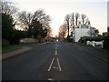
London Road, Cuckfield
Looking northwards towards Whitemans Green on the B2036 around sunrise. The entrance to Manor Drive is on the left whilst Durnford House is on the right.
Image: © Simon Carey
Taken: 6 Dec 2014
0.08 miles
9
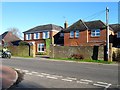
Pelham House, London Road, Cuckfield Road
Former Victorian villa that has been converted into a care home.
Image: © Simon Carey
Taken: 6 Dec 2014
0.09 miles
10
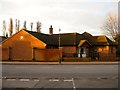
New House, London Road, Cuckfield
So new it is yet to be added to any map as the plaque on the wall to the left states its completion date as 2012. It also has its name but I neglected to remember it and the zoom on the original can't make it out, though it does begin with G. I'll have a look next time I'm up that way.
Image: © Simon Carey
Taken: 20 Dec 2014
0.10 miles