
IMAGES TAKEN NEAR TO
Cambridge Square, REDHILL, RH1 6TG
Introduction
This page details the photographs taken nearby to Cambridge Square, RH1 6TG by members of the Geograph project.
The Geograph project started in 2005 with the aim of publishing, organising and preserving representative images for every square kilometre of Great Britain, Ireland and the Isle of Man.

There are currently over 7.5m images from over14,400 individuals and you can help contribute to the project by visiting https://www.geograph.org.uk
Image Map
Images are licensed for reuse under creativecommons.org/licenses/by-sa/2.0
Notes
- Clicking on the map will re-center to the selected point.
- The higher the marker number, the further away the image location is from the centre of the postcode.
Image Listing (61 Images Found)
Images are licensed for reuse under creativecommons.org/licenses/by-sa/2.0
Image
Details
Distance
1
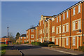
Royal Earlswood Park
See Image for background to this area. Unlike much of the other development on the site, this is a new build, rather than a conversion of previous hospital buildings.
Image: © Ian Capper
Taken: 15 Mar 2009
0.04 miles
2
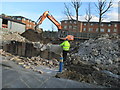
Demolition at YMCA East Surrey
Demolition of outdoor sports court prior to erection of an inclusive sports facility at YMCA East Surrey Sports & Community Centre, Princes Road, Redhill, Surrey, RH1 6JJ.http://www.ymcaeastsurrey.org.uk/building-work-starts-on-ymcas-new-inclusive-sports-facility/
Image: © Rib
Taken: 20 Mar 2018
0.05 miles
3
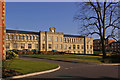
Royal Earlswood Park
See Image for info. This is the former workshop, now called Edward House. It is grade II listed - for listing particulars see www.historicengland.org.uk/listing/the-list/list-entry/1260527.
Image: © Ian Capper
Taken: 15 Mar 2009
0.06 miles
4
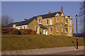
Royal Earlswood Park
See Image for info. This is the former infirmary, dating from 1877 and grade IIc listed i.e. in the curtilage of the main former hospital building listed at www.historicengland.org.uk/listing/the-list/list-entry/1241446. It is now called Helena House.
Image: © Ian Capper
Taken: 21 Mar 2009
0.06 miles
5
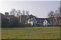
Royal Earlswood Park
See Image for info. This is the northern entrance, bounded by the two lodges on the right (see Image and Image), behind which is the former infirmary (now Helena House - see Image), with the tower of the original main building behind on the left (now Victoria House).
Image: © Ian Capper
Taken: 21 Mar 2009
0.06 miles
6
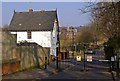
Royal Earlswood Park
See Image for info. This is the West Lodge, one of a pair at the northern entrance to the site, the East Lodge being just off picture to the right (see Image and Image). Both are grade II listed - for listing particulars see www.historicengland.org.uk/listing/the-list/list-entry/1033356. In the background can be seen the steeple of St John's Church (see Image).
Image: © Ian Capper
Taken: 21 Mar 2009
0.06 miles
7
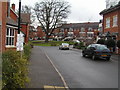
Housing redevelopment (Royal Earlswood Hospital)
Image: © N Chadwick
Taken: 15 Jan 2006
0.07 miles
8
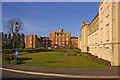
Royal Earlswood Park
See Image for info. On the right is the former workshop, now called Edward House (see Image). The former main building, now called Victoria Court, is beyond.
Image: © Ian Capper
Taken: 15 Mar 2009
0.07 miles
9
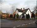
Royal Earlswood Park at the junction of Princes Road
This is the estate occupying the old Earlswood asylum
Image: © David Howard
Taken: 31 Jan 2016
0.07 miles
10
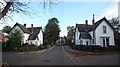
Asylum lodges
When it opened in 1855, no-one felt embarrassed with the name Asylum For Idiots - seen in the background. These two lodges stand at the entrance. They are listed buildings: http://www.heritagegateway.org.uk/Gateway/Results_Single.aspx?uid=471791&resourceID=5 . Asylum Arch Road goes off to the right. Further views: Image and Image
Image: © Roger W Haworth
Taken: 24 Oct 2010
0.07 miles