
IMAGES TAKEN NEAR TO
The Marlings, HAYWARDS HEATH, RH16 4TL
Introduction
This page details the photographs taken nearby to The Marlings, RH16 4TL by members of the Geograph project.
The Geograph project started in 2005 with the aim of publishing, organising and preserving representative images for every square kilometre of Great Britain, Ireland and the Isle of Man.

There are currently over 7.5m images from over14,400 individuals and you can help contribute to the project by visiting https://www.geograph.org.uk
Image Map
Images are licensed for reuse under creativecommons.org/licenses/by-sa/2.0
Notes
- Clicking on the map will re-center to the selected point.
- The higher the marker number, the further away the image location is from the centre of the postcode.
Image Listing (55 Images Found)
Images are licensed for reuse under creativecommons.org/licenses/by-sa/2.0
Image
Details
Distance
1
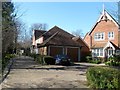
The Marlings, Bolnore Village
Small cul de sac off at the southern end of the Upper village adjacent to Bolnore Wood.
Image: © Simon Carey
Taken: 7 Mar 2015
0.01 miles
2
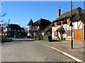
Woodmans Cottage, Renfields, Bolnore Village
Bolnore Village was planned around 2000-01 and involved the architects heading out across Sussex to take pictures of cottages and houses in other villages in order to build a new estate to replicate the feel of the Sussex village. The result is a mish mash of pretend historical styles which even includes one thatched property which the developers will tell you is built on the site of an old woodcutter's cottage. The houses beyond seem to be copying the old style Edwardian town house.
Image: © Simon Carey
Taken: 17 Feb 2015
0.04 miles
3
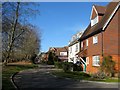
Heasewood, Bolnore Village
A cul de sac off Heyworth Ride that lies adjacent to Bolnore Wood.
Image: © Simon Carey
Taken: 7 Mar 2015
0.05 miles
4
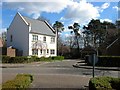
The Paddocks, Bolnore Village
A cul de sac off Heyworth Ride in the upper village, the first section of the new development to be completed.
Image: © Simon Carey
Taken: 31 Mar 2015
0.06 miles
5
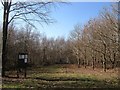
Bolnore Wood
Now a nature reserve open to the public, the old wood has been split in two by the construction of the A272 relief road. This is the eastern section adjacent to Bolnore Village.
Image: © Simon Carey
Taken: 7 Mar 2015
0.06 miles
6
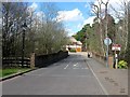
Bridge, Middle Village, Bolnore Village
The bridge takes the road called Middle Village over a series of ponds towards its junction with Renfields. The building in view is Image
Image: © Simon Carey
Taken: 31 Mar 2015
0.06 miles
7
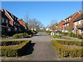
Heyworth Ride, Bolnore Village
The main thoroughfare for this section of the new development takes its name from the old manor that covered part of Haywards Heath. This section was once a field called Bushey Field according to Cuckfield's 1843 tithe map.
Image: © Simon Carey
Taken: 17 Feb 2015
0.07 miles
8
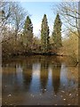
Bolnore Pond
One of a series that runs between the bridge connecting Bolnore upper and middle villages and Traunstein Way, the A272 relief road. The ponds also mark the northern edge of Catt's Wood and were once the parish boundary between Cuckfield and Keymer. In all likelihood they were formed by quarrying, either sandstone or marl.
Image: © Simon Carey
Taken: 31 Mar 2015
0.07 miles
9
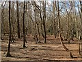
Catt's Wood
The remnant of a large wood that is squeezed between Bolnore middle village and Traunstein Way, the A272 relief road. The wood was removed to make way for the development of the village with this section now part of a nature reserve that takes in the remnants of all woods that were grubbed to make way for Bolnore.
Image: © Simon Carey
Taken: 31 Mar 2015
0.08 miles
10
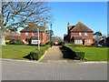
Belvedere Walk, Bolnore Village
New tile hung faux cottages off Heyworth Ride.
Image: © Simon Carey
Taken: 17 Feb 2015
0.09 miles