
IMAGES TAKEN NEAR TO
Fox Hill, HAYWARDS HEATH, RH16 4QQ
Introduction
This page details the photographs taken nearby to Fox Hill, RH16 4QQ by members of the Geograph project.
The Geograph project started in 2005 with the aim of publishing, organising and preserving representative images for every square kilometre of Great Britain, Ireland and the Isle of Man.

There are currently over 7.5m images from over14,400 individuals and you can help contribute to the project by visiting https://www.geograph.org.uk
Image Map
Images are licensed for reuse under creativecommons.org/licenses/by-sa/2.0
Notes
- Clicking on the map will re-center to the selected point.
- The higher the marker number, the further away the image location is from the centre of the postcode.
Image Listing (55 Images Found)
Images are licensed for reuse under creativecommons.org/licenses/by-sa/2.0
Image
Details
Distance
1
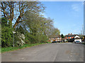
Car Park, Fox and Hounds, Fox Hill
Originally part of a small common known as Jeffreys Green that surrounded an old crossroads; the old north-south droveway that is now the modern B2112, Hurstwood Lane heading east, and another route that is now just a footpath going west. The first named route was turnpiked in 1770 as part of a main London-Brighton route which I'm guessing would be the origins of the Fox and Hound at the far end. Also constructed in what is now the car park was a toll house known as Cleavewaters after the nearby farm and marked on the 1875 OS map. By the next edition in 1899 it had gone.
Image: © Simon Carey
Taken: 10 Apr 2011
0.01 miles
3
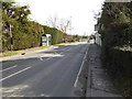
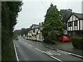
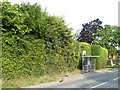
Fox Hill with bus stop at "Fox and Hounds" PH
This is in West Sussex.
Image: © Shazz
Taken: 28 Feb 2017
0.02 miles
4
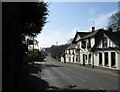
Fox and Hounds Inn, Fox Hill
Built on what was once a small common known as Jeffrey's Green probably in the 18th century when what is now the B2112 was turnpiked. A former toll booth existed at the end of the car park in the distance.
Image: © Simon Carey
Taken: 10 Apr 2011
0.02 miles
5
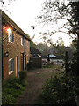
The Stables, Fox Hill
As the name suggests these dwellings have been converted from the former stables that lie to the rear of Image
Image: © Simon Carey
Taken: 17 Apr 2011
0.02 miles
7
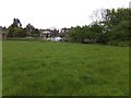
The rear of Scrase Hill Terrace
The houses front the B2112, Fox Hill and back onto this grassland
Image: © David Smith
Taken: 1 May 2014
0.04 miles
9
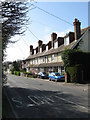
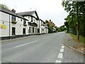
Scrase Hill Terrace, Fox Hill
Built in the first decade of the 20th century on what is now the B2112. The road's original name was Scrase's Hill but was changed to its current one, Fox Hill, after the Second World War.
Image: © Simon Carey
Taken: 10 Apr 2011
0.04 miles
10
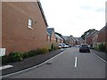
Ruppell Rise, Fox Hill
A newly created housing estate on a greenfield site
Image: © David Smith
Taken: 8 Jul 2019
0.05 miles