
IMAGES TAKEN NEAR TO
Gower Road, HAYWARDS HEATH, RH16 4PN
Introduction
This page details the photographs taken nearby to Gower Road, RH16 4PN by members of the Geograph project.
The Geograph project started in 2005 with the aim of publishing, organising and preserving representative images for every square kilometre of Great Britain, Ireland and the Isle of Man.

There are currently over 7.5m images from over14,400 individuals and you can help contribute to the project by visiting https://www.geograph.org.uk
Image Map
Images are licensed for reuse under creativecommons.org/licenses/by-sa/2.0
Notes
- Clicking on the map will re-center to the selected point.
- The higher the marker number, the further away the image location is from the centre of the postcode.
Image Listing (74 Images Found)
Images are licensed for reuse under creativecommons.org/licenses/by-sa/2.0
Image
Details
Distance
1
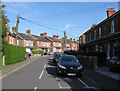
Gower Road
Residential street linking Ashenground Road to Haywards Road developed during the first decade of the 20th century.
Image: © Simon Carey
Taken: 10 Apr 2011
0.05 miles
2
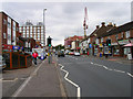
Sussex Road
An ancient highway that once crossed the lonely heath from Lindfield to Ditchling now the B2112. One of the main shopping streets of the town though not the original as the distance between buildings and pavement on both sides implies former gardens. The large building to the left was built in the late 1960s and included a Co-op department store at its base which has long gone. The crane to the right is currently helping to construct new buildings on the site of the former Sussex Hotel built at the crossroads in 1861 and originally known as the Volunteer.
Image: © Simon Carey
Taken: 30 Aug 2007
0.07 miles
3
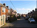
Gower Road, Haywards Heath
Developed as lower class housing in the 1880s and running from Ashenground Road in the south to Haywards Road to the north with a spur eastwards to Sussex road, see Image
Image: © Simon Carey
Taken: 8 Feb 2015
0.07 miles
4
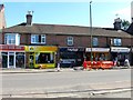
19-27, Sussex Road, Haywards Heath
Originally a set of cottages built some time during the 1860s possibly for workers who were employed in a nearby brickworks. Their conversion into shops probably came about at the time Sussex Road itself turned from a residential road into a commercial street.
Image: © Simon Carey
Taken: 7 Mar 2015
0.08 miles
5
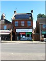
31, Sussex Road, Haywards Heath
Home to Ecotecture, eco friendly architects. The building seems to date from the early 20th century when Sussex Road was establishing itself as the southern end of the commercial sector of the town.
Image: © Simon Carey
Taken: 7 Mar 2015
0.08 miles
6
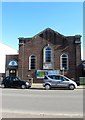
Haywards Heath Baptist Church, Sussex Road, Haywards Heath
The Methodists occupied a building here in 1876 and rebuilt it the following year, extending it in 1957. They moved out in 1991 and were replaced by the Baptists.
Image: © Simon Carey
Taken: 7 Mar 2015
0.08 miles
7
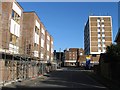
Gower Road, Haywards Heath
The road runs from Ashenground Road in the south to Haywards Road to the north with a third part heading east to Sussex Road. This is part of the latter with a new development on the left and Stockwell Court, the block of flats, to the right which was built in the early 1970s.
Image: © Simon Carey
Taken: 8 Feb 2015
0.08 miles
8
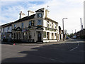
The Heath Tavern
Pub located at the junction of Sussex Road, the B2112, and Triangle Road. The building appears on the 1897 OS map but is not marked as a public house until 1910 most likely opened to serve the growing communities to the west and south.
Image: © Simon Carey
Taken: 10 Apr 2011
0.08 miles
9
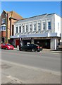
3-7, Sussex Road, Haywards Heath
Located between Sussex Gate to the left and Image out of shot to the right. It looks like a former cinema but isn't and was built to replace four 19th century cottages that once stood on this site.
Image: © Simon Carey
Taken: 7 Mar 2015
0.08 miles
10
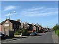
Ashenground Road
The road existed before the houses heading west towards Ashenground Wood which was built in the 1960s. The road itself was developed intermittently, the first houses on the left appearing in the first decade of the 20th century.
Image: © Simon Carey
Taken: 10 Apr 2011
0.10 miles