
IMAGES TAKEN NEAR TO
Whitelands, Franklynn Road, HAYWARDS HEATH, RH16 4HR
Introduction
This page details the photographs taken nearby to Whitelands, Franklynn Road, RH16 4HR by members of the Geograph project.
The Geograph project started in 2005 with the aim of publishing, organising and preserving representative images for every square kilometre of Great Britain, Ireland and the Isle of Man.

There are currently over 7.5m images from over14,400 individuals and you can help contribute to the project by visiting https://www.geograph.org.uk
Image Map
Images are licensed for reuse under creativecommons.org/licenses/by-sa/2.0
Notes
- Clicking on the map will re-center to the selected point.
- The higher the marker number, the further away the image location is from the centre of the postcode.
Image Listing (71 Images Found)
Images are licensed for reuse under creativecommons.org/licenses/by-sa/2.0
Image
Details
Distance
1
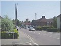
Water Tower and the road east out of Haywards Heath
The water tower marks the highest point in the town and nearby is the Princess Royal Hospital linked to The Royal Sussex County Hospital at Brighton.
Image: © Nigel Freeman
Taken: 27 Jun 2005
0.00 miles
2
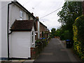
Petlands Gardens
Late Victorian terraced cottages in a small cul-de-sac off Franklynn Road though a footpath at the bottom connects to Kents Road.
Image: © Simon Carey
Taken: 30 Aug 2007
0.01 miles
3
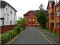
Whitelands
Built in the late 1980s on the site of a former builders yard owned by Thomas White Ltd that had occupied the spot from the early part of the century to the 1980s and had been responsible for building a fair proportion of the current town. The white building to the left was the old site office and is now a chartered accountants. Taken from the junction with Franklynn Road (A272).
Image: © Simon Carey
Taken: 30 Aug 2007
0.01 miles
4
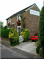
Tichbourne Cottage, Petlands Gardens
The only building on the northern side of the small lane opposite the terraced cottages. The whitewashed sign on the side of the building advertises Thomas Whites the builder that once occupied the yard between Petlands Gardens and Franklynn Road.
Image: © Simon Carey
Taken: 30 Aug 2007
0.02 miles
5
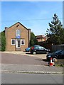
Kents Road Church, Kents Road, Haywards Heath
The meeting place of the Plymouth Brethren that was established here in the late 1930s having originally been located in South Road.
Image: © Simon Carey
Taken: 7 Apr 2015
0.03 miles
6
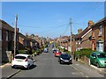
Kents Road, Haywards Heath
Viewed from the end of the road and looking north towards the distant junction with Triangle Road. Part of the road and a few houses appear on the 1897 OS map but was complete by the 1910 edition. Originally part of the parish of Wivelsfield until their transfer to Haywards Heath in 1933.
Image: © Simon Carey
Taken: 7 Apr 2015
0.05 miles
7
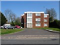
Franklynn Court, Franklynn Road, Haywards Heath
Built in the early 1970s on the site of Berry's coal yard.
Image: © Simon Carey
Taken: 7 Apr 2015
0.05 miles
8
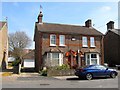
45-47, Kents Road, Haywards Heath
The semi-detached houses were built in the first decade of the 20th century with this pair originally called Transvaal Cottages according to the faded name board attached to the front.
Image: © Simon Carey
Taken: 7 Apr 2015
0.06 miles
9
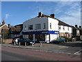
Off Licence, Franklynn Road
On the junction of the A272 and Western Road. There has been one here, albeit under different names, since at least the 1970s
Image: © Simon Carey
Taken: 10 Apr 2011
0.06 miles
10
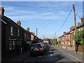
Petlands Road
Residential street linking Kents Road to Wivelsfield Road, the B2112. They were built during the 1860s as the town of Haywards Heath began to grow.
Image: © Simon Carey
Taken: 10 Apr 2011
0.07 miles