
IMAGES TAKEN NEAR TO
Tanners Cross, HAYWARDS HEATH, RH16 4GE
Introduction
This page details the photographs taken nearby to Tanners Cross, RH16 4GE by members of the Geograph project.
The Geograph project started in 2005 with the aim of publishing, organising and preserving representative images for every square kilometre of Great Britain, Ireland and the Isle of Man.

There are currently over 7.5m images from over14,400 individuals and you can help contribute to the project by visiting https://www.geograph.org.uk
Image Map
Images are licensed for reuse under creativecommons.org/licenses/by-sa/2.0
Notes
- Clicking on the map will re-center to the selected point.
- The higher the marker number, the further away the image location is from the centre of the postcode.
Image Listing (56 Images Found)
Images are licensed for reuse under creativecommons.org/licenses/by-sa/2.0
Image
Details
Distance
1
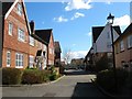
Tanners Cross, Bolnore Village
Small residential road that runs between Cattswood Lane and Updown Hill.
Image: © Simon Carey
Taken: 31 Mar 2015
0.00 miles
2
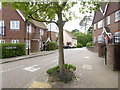
Tanners Cross
For a view the other way see http://www.geograph.org.uk/photo/4411458.
Image: © Shazz
Taken: 20 May 2016
0.02 miles
3
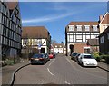
Updown Hill, Bolnore Village
Updown Hill forms a square around Image in the middle part of the Bolnore development with this section on the western side containing some fake timber framing.
Image: © Simon Carey
Taken: 7 Mar 2015
0.04 miles
4
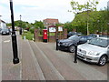
Steps with pillar box and notice boards in Bolnore Village
Image: © Shazz
Taken: 20 May 2016
0.04 miles
5
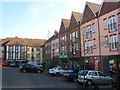
Co-operative Store, Middle Village, Bolnore Village
The main village square in the development contains the Co-op and a ladies hairdressers which is out of shot to the right. The square kind of has a continental feel to it but much is given over to car parking. There does not seem to be room for any extra shops either, at the very least a cafe which outside tables would be a nice touch. A lost opportunity here to turn this into a central area for the community.
Image: © Simon Carey
Taken: 7 Mar 2015
0.04 miles
6
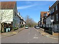
Middle Village, Bolnore Village
The name of the road that runs southwards from Renfields viewed from the junction with Updown Hill. Much of the area was once part of Catt's Wood.
Image: © Simon Carey
Taken: 7 Mar 2015
0.05 miles
7
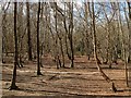
Catt's Wood
The remnant of a large wood that is squeezed between Bolnore middle village and Traunstein Way, the A272 relief road. The wood was removed to make way for the development of the village with this section now part of a nature reserve that takes in the remnants of all woods that were grubbed to make way for Bolnore.
Image: © Simon Carey
Taken: 31 Mar 2015
0.06 miles
8
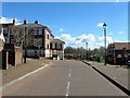
Updown Hill, Bolnore Village
The road actually forms a square that surrounds the small commercial section of the development which contains a small Co-op supermarket and hairdressers. This is the northern section of the square with Middle Village, the road heading off to the left towards the upper village and northern exit.
Image: © Simon Carey
Taken: 31 Mar 2015
0.06 miles
9
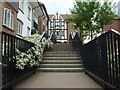
Steps to the south entrance to Bolnore Village Square
Heading north from Middle Village, this path heads toward the village square.
Image: © Curtis Bateman
Taken: 26 Jul 2010
0.06 miles
10
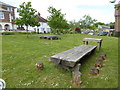
Looking across small garden in Bolnore Village
Image: © Shazz
Taken: 20 May 2016
0.06 miles