IMAGES TAKEN NEAR TO
Weavers Mead, HAYWARDS HEATH, RH16 4FR
Introduction
This page details the photographs taken nearby to Weavers Mead, RH16 4FR by members of the Geograph project.
The Geograph project started in 2005 with the aim of publishing, organising and preserving representative images for every square kilometre of Great Britain, Ireland and the Isle of Man.

There are currently over 7.5m images from over14,400 individuals and you can help contribute to the project by visiting https://www.geograph.org.uk
Image Map
Images are licensed for reuse under creativecommons.org/licenses/by-sa/2.0
Notes
- Clicking on the map will re-center to the selected point.
- The higher the marker number, the further away the image location is from the centre of the postcode.
Image Listing (59 Images Found)
Images are licensed for reuse under creativecommons.org/licenses/by-sa/2.0
Image
Details
Distance
1
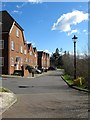
Weavers Mead, Bolnore Village
A cul de sac that heads south from Updown Hill in the shape of a 'T'.
Image: © Simon Carey
Taken: 31 Mar 2015
0.03 miles
2
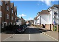
Updown Hill, Bolnore Village
Updown Hill actually forms a square around the central commercial area of the development which contains a small Co-op supermarket and a hairdressers. This is the southern part with Woodcote House on the right.
Image: © Simon Carey
Taken: 31 Mar 2015
0.06 miles
3
Farriers Lea, Bolnore Village
A cul de sac off Middle Village at the southern end of the middle portion of the new development.
Image: © Simon Carey
Taken: 31 Mar 2015
0.06 miles
4
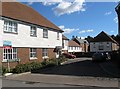
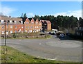
Housing at Middle Village/Pierces Lane
Recent housing in the Middle Village area of Bolnore Village.
Image: © Curtis Bateman
Taken: 26 Jul 2010
0.08 miles
5
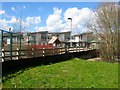
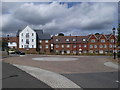
Bolnore Primary School, Bolnore Village
Opened in 2010 after a concerted effort by the locals to get the council to supply one as it was not included in the original development.
Image: © Simon Carey
Taken: 31 Mar 2015
0.08 miles
6
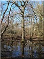
Pond, Ashenground Park
Located near the footpath that runs to the east of Bolnore Primary School.
Image: © Simon Carey
Taken: 7 Mar 2015
0.08 miles
7
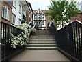
Steps to the south entrance to Bolnore Village Square
Heading north from Middle Village, this path heads toward the village square.
Image: © Curtis Bateman
Taken: 26 Jul 2010
0.09 miles
8
Pierce's Lane, Bolnore Village
Located off Middle Village and adjacent to the remnant of Pierce's Wood the rest of which is now occupied by this road.
Image: © Simon Carey
Taken: 7 Mar 2015
0.09 miles
9
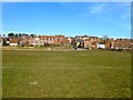
Tim Farmer Recreation Ground, Bolnore Village
The eastern end of the large recreation ground in the middle of the Bolnore development. See also Image
Image: © Simon Carey
Taken: 7 Mar 2015
0.09 miles
10
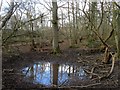
Pond, Ashenground Park
A lot smaller than my last visit three weeks ago, see Image
Image: © Simon Carey
Taken: 31 Mar 2015
0.09 miles