
IMAGES TAKEN NEAR TO
Lewes Road, HAYWARDS HEATH, RH16 4EY
Introduction
This page details the photographs taken nearby to Lewes Road, RH16 4EY by members of the Geograph project.
The Geograph project started in 2005 with the aim of publishing, organising and preserving representative images for every square kilometre of Great Britain, Ireland and the Isle of Man.

There are currently over 7.5m images from over14,400 individuals and you can help contribute to the project by visiting https://www.geograph.org.uk
Image Map
Images are licensed for reuse under creativecommons.org/licenses/by-sa/2.0
Notes
- Clicking on the map will re-center to the selected point.
- The higher the marker number, the further away the image location is from the centre of the postcode.
Image Listing (75 Images Found)
Images are licensed for reuse under creativecommons.org/licenses/by-sa/2.0
Image
Details
Distance
1
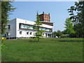
Princess Royal Hospital
Opened in 1991 and built in the grounds of the former St Francis Hospital. The water tower was added in 1908 whilst the green area in the foreground is on the site of a former burial area.
Image: © Simon Carey
Taken: 30 Apr 2011
0.01 miles
2
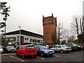
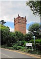
Water tower, Princess Royal Hospital, Haywards Heath
Image: © nick macneill
Taken: 17 Feb 2012
0.02 miles
3
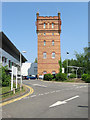
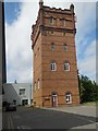
Water Tower, Princess Royal Hospital
Originally built in 1908 for what was then the Brighton Borough Lunatic Asylum which later became St Francis Hospital. The style matches that of the former institution. Still in use as a water tower today though now attached to the Princess Royal Hospital.
Image: © Simon Carey
Taken: 30 Apr 2011
0.02 miles
4
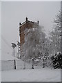
St Francis Water Tower
First heavy snow in 20 years covering Haywards Heath in January 2010. The tower was part of the old St Francis Hospital formerly a mental hospital, now a residential development. The tower was used during the war as a landmark by incoming bombers heading for London.
Image: © Geoff Dent
Taken: 6 Jan 2010
0.03 miles
5
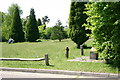
St. Francis Hospital Burial Ground
The Plaque on the granite post in the right foreground reads -
Within the boundary marked by the granite setts lie the last resting places of patients from St. Francis Hospital. 1893 - 1920.
Image: © Peter Jeffery
Taken: 1 Apr 2008
0.03 miles
8
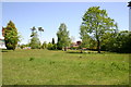
St. Francis Hospital Burial Ground
This open space is the Burial Ground used by St. Francis Hospital from 1893 - 1920. Behind the trees are the new buildings of The Princess Royal Hospital.
Image: © Peter Jeffery
Taken: 1 Apr 2008
0.04 miles
9
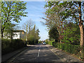
Colwell Road
Running between Lewes Road, the A272, and Fox Hill, the B2112, the route predates the construction of the town of Haywards Heath, originally forming the southern boundary of Otehall Common, the name of the Wivelsfield portion of the large common known as Haywards Heath. When the County Lunatic Asylum, later St Francis Hospital, was constructed in 1859 it was given the name, Asylum Road, which it retained until changing to its current name after the First World War.
This area of Haywards Heath was originally part of Wivelsfield parish until 1934.
Image: © Simon Carey
Taken: 10 Apr 2011
0.04 miles
10
Princess Royal Hospital grounds
Viewed from the Orthopaedic ward
Image: © Paul Gillett
Taken: 13 Jun 2015
0.05 miles