
IMAGES TAKEN NEAR TO
Kings Road, HAYWARDS HEATH, RH16 4EJ
Introduction
This page details the photographs taken nearby to Kings Road, RH16 4EJ by members of the Geograph project.
The Geograph project started in 2005 with the aim of publishing, organising and preserving representative images for every square kilometre of Great Britain, Ireland and the Isle of Man.

There are currently over 7.5m images from over14,400 individuals and you can help contribute to the project by visiting https://www.geograph.org.uk
Image Map
Images are licensed for reuse under creativecommons.org/licenses/by-sa/2.0
Notes
- Clicking on the map will re-center to the selected point.
- The higher the marker number, the further away the image location is from the centre of the postcode.
Image Listing (73 Images Found)
Images are licensed for reuse under creativecommons.org/licenses/by-sa/2.0
Image
Details
Distance
1
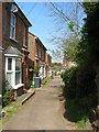
Kings Road, Haywards Heath
Little more than a path heading north from St John's Road to a set of three semi-detached cottages and a single house at the end of the path that were built in the first decade of the 20th century.
Image: © Simon Carey
Taken: 7 Apr 2015
0.01 miles
2
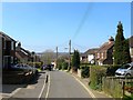
St John's Road, Haywards Heath
A narrow lane that originally linked Wivelsfield Road to Colwell Road though the junction with the latter has been cut off by the development of Image The road itself existed from the late 1850s onwards and has been developed piecemeal over the years with those on the northern side older than those to the south.
Image: © Simon Carey
Taken: 7 Apr 2015
0.05 miles
3
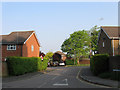
St Francis Close
Small cul-de-sac off Colwell Road built in the 1990s lopping off the top of the older St Johns Road. This area of Haywards Heath was part of Wivelsfield parish until 1934.
Image: © Simon Carey
Taken: 30 Apr 2011
0.06 miles
4
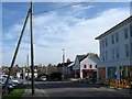
New Retail Units, Wivelsfield Road
A Sainsbury's local and a new pet store have been built on the site of the Duck public house which was demolished in 2010. Built in the 1860s as the New Inn which became the Ugly Duckling in the 1960s before being shortened to the Duck in 2001.
This part of Haywards Heath was once part of two parishes, Keymer on the left hand side of the road and Wivelsfield on the right.
Image: © Simon Carey
Taken: 10 Apr 2011
0.06 miles
5
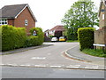
Looking into St Francis Close
See also http://www.geograph.org.uk/photo/2387231 from 2011.
Image: © Shazz
Taken: 20 May 2016
0.06 miles
6
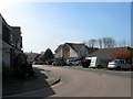
St Francis Close, Haywards Heath
Built in the 1990s on the site of two semi-detached houses called Acunba and Hazeldene and in the process eradicating the northern end of St John's Road.
Image: © Simon Carey
Taken: 7 Apr 2015
0.07 miles
7
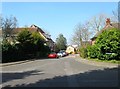
Colwell Gardens, Haywards Heath
Originally built as a 1930s council estate with the residences on the eastern side and allotment gardens to the west, the former was replaced in 2005 by Image whilst the latter was built over during the 1980s.
Image: © Simon Carey
Taken: 7 Apr 2015
0.07 miles
8
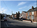
Wivelsfield Road
Currently the B2112 but has its origins as a drove road from Ditchling in the south to the large expanse of heath commons at this location prior to the arrival of the railway and subsequent growth of the town. The new building amongst the cottages is the Services Club whilst the big building in the distance is Image
This area of Haywards Heath was once part of two parishes, Keymer on the western side of the road, and Wivelsfield on the east.
Image: © Simon Carey
Taken: 10 Apr 2011
0.08 miles
9
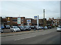
Dinnages car dealership.Haywards Heath
Image: © Stacey Harris
Taken: 23 Jan 2010
0.08 miles
10
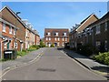
Wellswood, Haywards Heath
A cul de sac built around 2004-05 on the site of a former 1930s council estate called Colwell Gardens part of which survives to the west.
Image: © Simon Carey
Taken: 7 Apr 2015
0.08 miles