1
Drummond Close, Haywards Heath
A cul de sac off Sunnywood Drive that also has pedestrian access to Victoria Park which is located to the immediate north. Built in the 1980s in the grounds of a large house built between the wars.
Image: © Simon Carey
Taken: 17 Feb 2015
0.03 miles
2
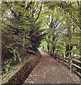
Path to Drummond Close, Haywards Heath
Linking the northern end of Sunnywood Drive to the close and then Victoria Park. Part of the park built on the former spoil heap made by the construction of the railway in 1841 can be seen beyond.
Image: © Simon Carey
Taken: 7 Apr 2015
0.04 miles
3
Victoria Park, Haywards Heath
This wooded section on the western side of the park lies upon a mound of earth created by the excavation of nearby Haywards Heath Tunnel on the London-Brighton railway in 1841. The mound remained in the ownership of the railway until 1863 when locals regained control and became part of Victoria Park in 1897.
Image: © Simon Carey
Taken: 8 Feb 2015
0.06 miles
4
Woodland Between Victoria Park and the Brighton Mainline
Image: © Thoma
Taken: 29 Dec 2016
0.06 miles
5
Wealden Way, Haywards Heath
Built in the 1970s on fields formerly belonging to Great Haywards Farm, whose 16th century farmhouse still stands in grounds beyond the trees to the left. This is the southern end of the road which is accessed via Bolnore Road.
Image: © Simon Carey
Taken: 7 Mar 2015
0.08 miles
6
Victoria Park Haywards Heath
Image: © PAUL FARMER
Taken: 4 Oct 2022
0.09 miles
7
Victoria Park Haywards Heath
Image: © PAUL FARMER
Taken: 4 Oct 2022
0.10 miles
8
Victoria Park
Originally part of the heath before becoming a public park in the late 19th century. Out of picture to the right a wooded area rises on a mound built from spoil from the London-Brighton railway. The park is on South Road and is the main open space in town.
Image: © Simon Carey
Taken: 30 Aug 2007
0.10 miles
9
Wood Ride, Haywards Heath
A residential road linking Ashenground Road to the south and Park Road to the north. Built in the 1930s on the site of what was Great Haywards Wood.
Image: © Simon Carey
Taken: 8 Feb 2015
0.10 miles
10
Brazier Beacon, Victoria Park, Haywards Heath
Erected in 2005 to be lit at times of important celebrations. The wooded area on the western side of the park lies on a large mound formed by the waste when Haywards Heath tunnel and cutting were excavated in the 1840s.
Image: © Simon Carey
Taken: 17 Feb 2015
0.12 miles


