IMAGES TAKEN NEAR TO
Tylers Green, HAYWARDS HEATH, RH16 4BT
Introduction
This page details the photographs taken nearby to Tylers Green, RH16 4BT by members of the Geograph project.
The Geograph project started in 2005 with the aim of publishing, organising and preserving representative images for every square kilometre of Great Britain, Ireland and the Isle of Man.

There are currently over 7.5m images from over14,400 individuals and you can help contribute to the project by visiting https://www.geograph.org.uk
Image Map
Images are licensed for reuse under creativecommons.org/licenses/by-sa/2.0
Notes
- Clicking on the map will re-center to the selected point.
- The higher the marker number, the further away the image location is from the centre of the postcode.
Image Listing (34 Images Found)
Images are licensed for reuse under creativecommons.org/licenses/by-sa/2.0
Image
Details
Distance
1
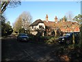
Yew Cottage/The Old Cottage, Tyler's Green, Haywards Heath
Located at the junction of Tyler's Green, the A272, and Chownes Mead Lane, with the area having once been a small common or green which the building would have looked out upon. A dwelling is marked here on a 1638 estate map and may well be part of the current building which has now been split into two residences.
Image: © Simon Carey
Taken: 17 Feb 2015
0.01 miles
3
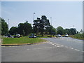
Butler's Green roundabout
A fairly new road layout to enable a possible Haywards Heath by-pass to be taken south of the town.
Image: © Nigel Freeman
Taken: 27 Jun 2005
0.06 miles
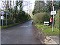
5
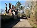
Coach House, Chownes Mead Lane, Haywards Heath
Built just after the First World War as the coach house for Chownes Mead, a faux Jacobean country house built on the site of a former farm called Chownes by banker Sir Alexander Kleinwort. Chownes Mead Lane was originally known as Chownes Road and is an old route linking Tylers Green to Isaac's Lane and is marked as such on a 1638 estate map. Later it became the B2164 until Isaac's Lane was rerouted and the western send at Tyler's Green is now closed.
Image: © Simon Carey
Taken: 17 Feb 2015
0.10 miles
6
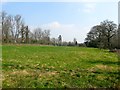
Lower Gunners
The name of the field according to Cuckfield's 1843 tithe map. this small strip is all that remains of the field with the western portion lost to housing and the rerouting of Copyhold Lane. The latter originally ran diagonally from left to right forming an old parish boundary between Cuckfield and a small detached portion of Keymer. When Stafford House, later the Hilton Park Hotel, was built, the old section from Tylers Green was taken over as a drive to the new house and the lane rerouted along the line of trees to the east.
Image: © Simon Carey
Taken: 9 Apr 2015
0.10 miles
7
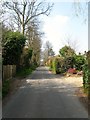
Copyhold Lane, Cuckfield
This section of the lane was added in the late 19th century to replace the old route which was taken over by the owners of newly constructed Stafford House to use as a drive. The current road is private but is a public bridleway.
Image: © Simon Carey
Taken: 9 Apr 2015
0.11 miles
8
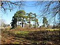
Dutch Barn Field
The name of the field according to Cuckfield's 1843 tithe map that was originally bounded by Tyler's Green, the A272, to the north, Isaac's Lane, the A273, and The Paddocks to the east, Chownes Mead Lane to the south. Part of the field was lost when Isaac's Lane was rerouted to the west of The Paddocks in the 1990s.
Image: © Simon Carey
Taken: 17 Feb 2015
0.11 miles
9
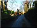
Copyhold Lane, Cuckfield
Looking eastwards towards the junction with the A272. This section was built in the late 19th century where previously the route veered south joining the main road at the same place as Chownes Mead Lane. That section is now the private drive for Burnt House Farm and the Hilton Park Hotel. A very upmarket area full of big houses behind even bigger hedges.
Image: © Simon Carey
Taken: 13 Dec 2014
0.12 miles