1
Beech Hurst Close, Haywards Heath
Small cul de sac off Bolnore Road that lies to the east of Beech Hurst gardens.
Image: © Simon Carey
Taken: 8 Feb 2015
0.02 miles
2
Bolnore Road, Haywards Heath
Not marked on Cuckfield's 1843 tithe map but in place by the first edition of the OS map in 1874 to enable access to Bolnore House from the east. The houses in view were added in the late 19th century whilst Wealden Way on the left was built in the late 1970s.
Image: © Simon Carey
Taken: 30 Mar 2015
0.04 miles
3
Police Station, Bolnore Road, Haywards Heath
The original police station was in Paddockhall Road from 1887 until its move here in the late 1980s along with the neighbouring law courts which have recently been demolished. A house called Elfinsward originally stood here from its construction in the 1860s to its demolition in 1973, having been purchased by the Sussex police authorities who then spent a number of years in legal wrangles trying to develop the site.
Image: © Simon Carey
Taken: 30 Mar 2015
0.05 miles
4
Site of Former Law Courts, Bolnore Road, Haywards Heath
Haywards Heath first acquired its own court in 1888 when the bench moved from Cuckfield and occupied a building near the station in Paddockhall Road where it stayed until the 1980s when it moved to this site, once occupied by a house called Elfinsward built in the 1860s which became a Diocesan Conference Centre from 1928 and until its sale to Sussex Police in 1973 who subsequently demolished it but then had to wait a number of years of legal wrangling to finally be able to build a new police station. The magistrates court sat until 2012 when it was closed as part of the government's cost cutting measures with the building being demolished and set to be replaced by sheltered housing.
Image: © Simon Carey
Taken: 30 Mar 2015
0.05 miles
5
Haywards Heath Law Courts and Police Station
In Bolnore Road in the west of the town.
Image: © Curtis Bateman
Taken: 26 Jul 2010
0.05 miles
6
Play area, Beech Hurst Gardens
Very pleasant public gardens.
Image: © Robin Webster
Taken: 14 Mar 2010
0.05 miles
7
Dolphin Public House
This was known as the Sergison Arms (The Sarge) since 1840s but became the Dolphin in the 1990s. It is opposite Haywards Heath police station so no rowdiness please!
Image: © Nigel Freeman
Taken: 2 Jul 2005
0.05 miles
8
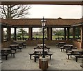
Quadrangle, Beech Hurst Gardens, Haywards Heath
The quadrangle is a semi open area that was built in 1953 on the site of the former large Victorian house called Beech Hurst. The last owner had bequeathed both house and gardens to the council to be used for public enjoyment. However, the house had not been lived in since 1940 and used by the military during the war and was seen to be beyond repair and pulled down not long after it was acquired in 1950. The quadrangle was built next to the former stables and billiard room which were turned into tea rooms but were pulled down in a revamp around 2002, however, the quadrangle survived and has now been integrated into the newly built Harvester public house.
Image: © Simon Carey
Taken: 7 Apr 2015
0.07 miles
9
Beech Hurst, Beech Hurst Gardens, Haywards Heath
Originally the site of the house called beech Hurst which was built sometime in the 1860s and went through a variety of owners until the last, William Yapp, bequeathed the house and grounds to the local council on condition it was turned into an amenity to be enjoyed by the public. The house itself was used as a convalescent home in World War One and an army camp during World War Two, and with the death of Yapp in 1946 had probably fallen into disrepair by the time it was acquired by the council in 1950 and was subsequently demolished in 1952 with exception of the stable block and billiard room. On the site of the former house a quadrangle was constructed which was retained when current owners acquired the complex and removed the stables and billiard room and built the current public house.
Image: © Simon Carey
Taken: 30 Mar 2015
0.07 miles
10
Butlers Green Road, Haywards Heath
Up to the autumn of 2014 it was the A272 which has now been rerouted to the south of the town with the old course redesigned the B2272. The road runs from the western end of Muster Green to the junction with Isaac's Lane which was the former location of Butlers Green after which it becomes Tylers Green. Viewed from the junction with Bolnore Road.
Image: © Simon Carey
Taken: 31 Mar 2015
0.07 miles


