
IMAGES TAKEN NEAR TO
Henry Mews, HAYWARDS HEATH, RH16 3UT
Introduction
This page details the photographs taken nearby to Henry Mews, RH16 3UT by members of the Geograph project.
The Geograph project started in 2005 with the aim of publishing, organising and preserving representative images for every square kilometre of Great Britain, Ireland and the Isle of Man.

There are currently over 7.5m images from over14,400 individuals and you can help contribute to the project by visiting https://www.geograph.org.uk
Image Map
Images are licensed for reuse under creativecommons.org/licenses/by-sa/2.0
Notes
- Clicking on the map will re-center to the selected point.
- The higher the marker number, the further away the image location is from the centre of the postcode.
Image Listing (120 Images Found)
Images are licensed for reuse under creativecommons.org/licenses/by-sa/2.0
Image
Details
Distance
1
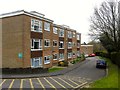
Mayflower Court, Haywards Heath
Small cul de sac containing a couple of blocks of flats that were constructed in the mid 1960s on the site of a former corporation yard.
Image: © Simon Carey
Taken: 30 Mar 2015
0.09 miles
2
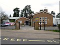
Warden Park Primary Academy, New England Road, Haywards Heath
Opened in 1951 as Haywards Heath Primary it later became Heyworth until 2012 when it was taken over by the trust that runs Warden Park in Cuckfield. The blue plaque above the gatepost on the right is for the author Anna Sewell who resided for a time at Petlands, a nearby house long gone, whose grounds covered much of the area now containing the school.
Image: © Simon Carey
Taken: 30 Mar 2015
0.09 miles
3
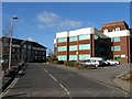
St Joseph's Way, Haywards Heath
Built in the early 1980s as part of the Orchards shopping centre development linking Hazelgrove road to Church Road and providing access to a couple of car parks and these office blocks at the northern end.
Image: © Simon Carey
Taken: 8 Feb 2015
0.10 miles
4
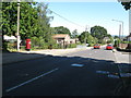
New England Road Haywards Heath
Heyworth Primary School is on the left.
Image: © Dave Spicer
Taken: 7 Sep 2012
0.10 miles
5
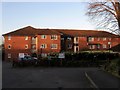
Clover Court, Church Road, Haywards Heath
A block of retirement flats built in 1988 on the site of a former Victorian townhouse.
Image: © Simon Carey
Taken: 8 Feb 2015
0.11 miles
6
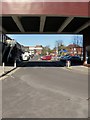
St Joseph's Way, Haywards Heath
Opened in 1981 as a service road for the shops on the eastern side of The Orchards shopping centre. It links Hazelgrove Road to Church Road and also provides access to the Tesco Express store and short term car park.
Image: © Simon Carey
Taken: 7 Mar 2015
0.12 miles
7
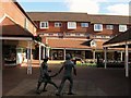
The Orchards, South Road, Haywards Heath
A shopping precinct built between 1980-82 accessed from South Road one of the main shopping streets of the town. The bronze sculpture in the foreground seems to have been moved since 2005, see Image and Image taken from the same spot. Marks & Spencer is to the left with Superdrug and Boots straight ahead.
Image: © Simon Carey
Taken: 1 Feb 2015
0.13 miles
8
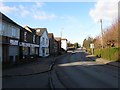
Hazelgrove Road, Haywards Heath
The B2112 heading north from Sussex Square. The road predates the town following what was an old track over barren heathland and began to be developed in the 1870s particularly the western side whilst the eastern side remained part of the grounds of the Priory of Our Lady with some development during the 10th century, particularly Image and St Joseph's School. At the junction with Church Road the name changes to Oathall Road.
Image: © Simon Carey
Taken: 8 Feb 2015
0.13 miles
9
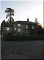
4, Church Road, Haywards Heath
A former Victorian town house now boarded up and probably awaiting redevelopment into flats. Many of these older houses were built with large grounds attached with the latter becoming far more valuable than the property standing within it.
Image: © Simon Carey
Taken: 8 Feb 2015
0.13 miles
10
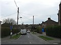
Mayflower Road, Haywards Heath
A residential road that runs between New England Road and Woodlands Road and built by the council in 1925.
Image: © Simon Carey
Taken: 30 Mar 2015
0.14 miles