IMAGES TAKEN NEAR TO
The Welkin, HAYWARDS HEATH, RH16 2PH
Introduction
This page details the photographs taken nearby to The Welkin, RH16 2PH by members of the Geograph project.
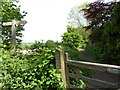
The Geograph project started in 2005 with the aim of publishing, organising and preserving representative images for every square kilometre of Great Britain, Ireland and the Isle of Man.

There are currently over 7.5m images from over14,400 individuals and you can help contribute to the project by visiting https://www.geograph.org.uk
Image Map
Images are licensed for reuse under creativecommons.org/licenses/by-sa/2.0
Notes
- Clicking on the map will re-center to the selected point.
- The higher the marker number, the further away the image location is from the centre of the postcode.
Image Listing (156 Images Found)
Images are licensed for reuse under creativecommons.org/licenses/by-sa/2.0
Image
Details
Distance
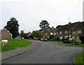
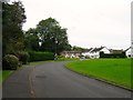
1
Green Meadows, Lindfield
Small cul de sac off Image that was developed in the 1970s on the site of a former house of the same name.
Image: © Simon Carey
Taken: 6 Sep 2015
0.02 miles
2
Finches Lane, Lindfield
Originally the highway to Kenwards now an access road for Image as well as a public footpath.
Image: © Simon Carey
Taken: 6 Sep 2015
0.05 miles
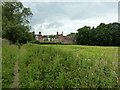
3
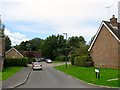
The Welkin, Lindfield
An estate built in the 1960s on the site of a large Victorian house and its grounds of the same name. The original plans were for a set of high rise flats which resulted in a fierce battle with local residents leading to the formation of a local preservation society. The latter were victorious and had a hand in the design of the new estate which ironically housed more people than the proposed flats. The original Welkin had been developed by a former vicar and for a time was used as vicarage before becoming first a private residence and later a private boarding school.
Image: © Simon Carey
Taken: 6 Sep 2015
0.05 miles
4
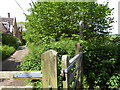
Footpath junction at the northern end of Finches Lane
Image: © Shazz
Taken: 20 May 2016
0.09 miles
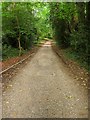
6
West along the Sussex Ouse Valley Way
The unusual building backs onto Finches Close.
Image: © Dave Spicer
Taken: 10 Jul 2011
0.09 miles
8
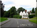
Finches Corner, Hickman's Lane, Lindfield
Originally built as a lodge for a large Victorian house called Finches which became a private residence when the Tudor style mansion was turned into a country hotel. The latter was demolished in 1964 to make way for a new housing estate, see Image and Image, with the former lodge now located at the junction with the access road and Image
Image: © Simon Carey
Taken: 6 Sep 2015
0.10 miles
9
Finches Gardens, Lindfield
A residential estate built in 1964 in the grounds and on the site of a former Tudor mansion house called Finches. The entrance from Hickman's Lane still retains a wide curve that follows the line of a former drive, with the area on the right between the road and Image left as open space.
Image: © Simon Carey
Taken: 6 Sep 2015
0.10 miles
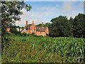
10
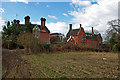
Finches - the original buildings
Much of the Finches estate has been built on, but these old buildings remain, divided up now into several dwellings.
Image: © Robin Webster
Taken: 14 Mar 2010
0.10 miles