
IMAGES TAKEN NEAR TO
Sydney Road, HAYWARDS HEATH, RH16 1QE
Introduction
This page details the photographs taken nearby to Sydney Road, RH16 1QE by members of the Geograph project.
The Geograph project started in 2005 with the aim of publishing, organising and preserving representative images for every square kilometre of Great Britain, Ireland and the Isle of Man.

There are currently over 7.5m images from over14,400 individuals and you can help contribute to the project by visiting https://www.geograph.org.uk
Image Map
Images are licensed for reuse under creativecommons.org/licenses/by-sa/2.0
Notes
- Clicking on the map will re-center to the selected point.
- The higher the marker number, the further away the image location is from the centre of the postcode.
Image Listing (111 Images Found)
Images are licensed for reuse under creativecommons.org/licenses/by-sa/2.0
Image
Details
Distance
1
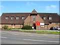
St Richards Church, Sydney Road, Haywards Heath
The church was completed and consecrated in 1938 to replace an older chapel that had stood on the corner of Church Avenue since 1897.
Image: © Simon Carey
Taken: 7 Apr 2015
0.02 miles
2
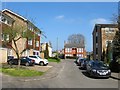
Park View, Haywards Heath
A small cul de sac off Sydney Road that backs onto The Heath recreation ground. Developed in the mid 1960s on the site of two Victorian semi-detached houses.
Image: © Simon Carey
Taken: 7 Apr 2015
0.03 miles
3
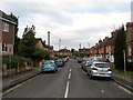
Church Avenue, Haywards Heath
Small residential road linking Sydney Road to Queens Road built in the first decade of the 20th century.
Image: © Simon Carey
Taken: 1 Feb 2015
0.05 miles
4
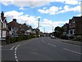
Queens Road, Haywards Heath
Built in the late 1880s after the destruction of a brewery on Mill Green Road allowed access at the western end and the break up of Southlands Farm freed the land for housing development. The current road runs from Mill Green Road to Oathall Road.
Image: © Simon Carey
Taken: 31 Mar 2015
0.05 miles
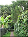
6
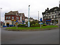
Commercial Square
The early commercial hub of the settlement around the new station before it moved southwards to its present site at the turn of the 20th century. The roundabout was added in 1965.
Image: © Simon Carey
Taken: 30 Aug 2007
0.09 miles
7
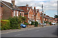
Queens Road
Taken from its junction with Church Avenue.
Image: © Trevor Harris
Taken: 18 Sep 2010
0.09 miles
8
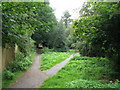
The parting of the ways
Just round the corner from the end of Image
Image: © Mike Quinn
Taken: 31 Jul 2008
0.09 miles
9
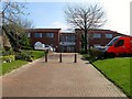
Sussex House, Perrymount Road, Haywards Heath
Currently occupied by Collinson Insurance. The building is located on the site of a former large Victorian house called Clair House which became St Clair House then just St Clair where during the latter's time it became a private girls school which ran between the 1930s and 1969 and was demolished soon after.
Image: © Simon Carey
Taken: 7 Apr 2015
0.09 miles
10
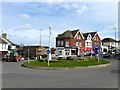
Commercial Square, Haywards Heath
Now a roundabout with the entrance to Mill Green Road to the left and Sydney Road to the right. The small parade of shops was built in 1893 on the site of a former brewery which opened in the early 1870s and burnt down in 1888. Originally one general store known as Beeny's which operated until the 1920s whereupon it was subdivided into the different units seen today.
Image: © Simon Carey
Taken: 30 Mar 2015
0.09 miles