
IMAGES TAKEN NEAR TO
Hillford Place, REDHILL, RH1 5AU
Introduction
This page details the photographs taken nearby to Hillford Place, RH1 5AU by members of the Geograph project.
The Geograph project started in 2005 with the aim of publishing, organising and preserving representative images for every square kilometre of Great Britain, Ireland and the Isle of Man.

There are currently over 7.5m images from over14,400 individuals and you can help contribute to the project by visiting https://www.geograph.org.uk
Image Map
Images are licensed for reuse under creativecommons.org/licenses/by-sa/2.0
Notes
- Clicking on the map will re-center to the selected point.
- The higher the marker number, the further away the image location is from the centre of the postcode.
Image Listing (24 Images Found)
Images are licensed for reuse under creativecommons.org/licenses/by-sa/2.0
Image
Details
Distance
1
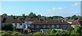
Houses at South Earlswood
On Prince Albert Square, seen from a train south of Earlswood station.
Image: © Derek Harper
Taken: 1 Oct 2015
0.11 miles
3
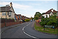
Hillford Place
Part of the development of South Earlswood between the Horley Road and the railway that started in the late 1930s.
Image: © Ian Capper
Taken: 20 Jun 2012
0.13 miles
4
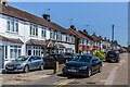
Prince Albert Square
c.1930s housing off Horley Road. The name derives from pub on the opposite side of Horley Road, originally the Prince Albert, now a McDonald's restaurant.
Image: © Ian Capper
Taken: 16 Jun 2021
0.17 miles
5
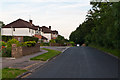
West Avenue
Part of the development of South Earlswood between the Horley Road and the railway that started in the late 1930s.
Image: © Ian Capper
Taken: 20 Jun 2012
0.17 miles
6
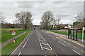
A23 Horley Road
Entering South Earlswood with Petridgewood Common on the left.
Image: © Robin Webster
Taken: 23 Mar 2019
0.18 miles
7
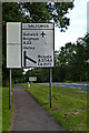
Signs old and new
Sign on the A23 Horley Road in South Earlswood. In the background, next to the Salfords sign, is the milepost in Image
Image: © Ian Capper
Taken: 20 Jun 2012
0.20 miles
9
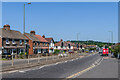
Horley Road
The A23 through South Earlswood.
Image: © Ian Capper
Taken: 16 Jun 2021
0.21 miles
10
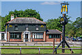
Former Prince Albert
Former pub (see http://www.francisfrith.com/salfords/photos/the-prince-albert-c1965_s45009/ ), now a McDonald's restaurant. Compare Image - since that photo was taken in 2011, the sign has gained some extra supports.
Image: © Ian Capper
Taken: 16 Jun 2021
0.21 miles