IMAGES TAKEN NEAR TO
Saucelands Lane, HORSHAM, RH13 8QG
Introduction
This page details the photographs taken nearby to Saucelands Lane, RH13 8QG by members of the Geograph project.
The Geograph project started in 2005 with the aim of publishing, organising and preserving representative images for every square kilometre of Great Britain, Ireland and the Isle of Man.

There are currently over 7.5m images from over14,400 individuals and you can help contribute to the project by visiting https://www.geograph.org.uk
Image Map (Loading...)


Getting Data...Please wait
Leaflet Map data © OpenStreetMap
Images are licensed for reuse under creativecommons.org/licenses/by-sa/2.0
Notes
- Clicking on the map will re-center to the selected point.
- The higher the marker number, the further away the image location is from the centre of the postcode.
Image Listing (12 Images Found)
Images are licensed for reuse under creativecommons.org/licenses/by-sa/2.0
Image
Details
Distance
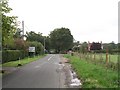
1
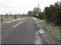
East along Saucelands Road
South of Coolham village
Image: © Dave Spicer
Taken: 31 Jan 2010
0.05 miles
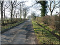
2
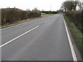
Crossroads on the B2139
Near Saucelands Farm
Image: © Dave Spicer
Taken: 31 Jan 2010
0.06 miles
3
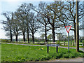
Trees at the crossroads
Saucelands Lane meets Coolham Road, and its line is continued across the junction by the dead-end Sproutes Lane, out of sight to the right.
Image: © Robin Webster
Taken: 11 Apr 2011
0.06 miles
4
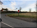
Post Box
RH13 102 Five Mile Ash (Horsham)
Image: © The Saunterer
Taken: 2 Dec 2012
0.06 miles
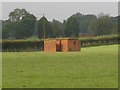
5
Coolham Advanced Landing Ground
Seen from Image all that remains is a brick structure (either an air raid shelter or machine gun post) and a section of concrete apron (allegedly).
Image: © Andy Potter
Taken: 10 Oct 2006
0.08 miles
6
Junction of Coolham Road (B2139) and Saucelands Road
The site of Image is in the field to the right. For more information see the Coolham ALG website http://www.roll-of-honour.com/Sussex/CoolhamAdvancedLanding.html.
Image: © Andy Potter
Taken: 10 Oct 2006
0.11 miles
7
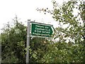
Coolham ALG sign
10m north of Image is a sign pointing into a big open field used for grazing livestock is all that remains of Image except for the Image
Image: © Andy Potter
Taken: 10 Oct 2006
0.11 miles
8
Sproutes Lane off the B2139
A dead end road that leads to Sproutes House, Sproutes Farm and Goringlee.
Image: © Dave Spicer
Taken: 11 Feb 2012
0.13 miles
9
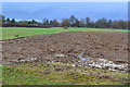
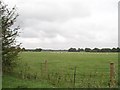
View across field from Saucelands Lane
Image: © David Martin
Taken: 29 Jan 2018
0.14 miles
10
Last building at Coolham ALG
Everything else at Image has gone. Either an air raid shelter or machine gun post (if you know please tell me).
Image: © Andy Potter
Taken: 10 Oct 2006
0.15 miles