IMAGES TAKEN NEAR TO
Hangerwood, HORSHAM, RH13 8HJ
Introduction
This page details the photographs taken nearby to Hangerwood, RH13 8HJ by members of the Geograph project.
The Geograph project started in 2005 with the aim of publishing, organising and preserving representative images for every square kilometre of Great Britain, Ireland and the Isle of Man.

There are currently over 7.5m images from over14,400 individuals and you can help contribute to the project by visiting https://www.geograph.org.uk
Image Map
Images are licensed for reuse under creativecommons.org/licenses/by-sa/2.0
Notes
- Clicking on the map will re-center to the selected point.
- The higher the marker number, the further away the image location is from the centre of the postcode.
Image Listing (21 Images Found)
Images are licensed for reuse under creativecommons.org/licenses/by-sa/2.0
Image
Details
Distance
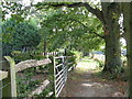
1
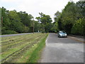
Residential road running parallel to the A281
Image: © Dave Spicer
Taken: 19 Sep 2009
0.01 miles
2
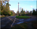
Hangerwood, Shermanbury
Name of the small road to the right containing bungalows built in the 1950s next to Brighton Road, the A281. This is the northernmost section of the village of Shermanbury which is strung out along the main road from Mock Bridge to the south.
Image: © Simon Carey
Taken: 22 Nov 2008
0.02 miles
3
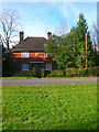
Cottages, Brighton Road, Shermanbury
Some of the older cottages built, according to the stone at the front in 1902, along this section of the road. Shermanbury is a ribbon settlement strung out along the A281 from Mock Bridge in the south to the northern edge of this grid square.
Image: © Simon Carey
Taken: 22 Nov 2008
0.04 miles
4
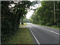
Looking south on the A 281 towards Shermanbury and Henfield further south
Image: © Dave Spicer
Taken: 19 Sep 2009
0.05 miles
6
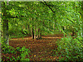
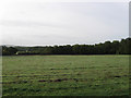
Flatfield Shaws
The name of the wood that is bounded by a footpath to the north and the A281 to the west. The wood seems to have been planted during the last decade of the 19th century as this part of the wood was once the western edge of Plum Tree Field.
Image: © Simon Carey
Taken: 2 Oct 2010
0.08 miles

8
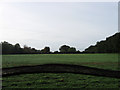
East Barn Field
The name of the field according to the 1840 tithe map viewed from Greentree Lane. Morley is the house just visible at the end of the field.
Image: © Simon Carey
Taken: 2 Oct 2010
0.11 miles
9
Tennis court alongside footpath to the A281
Image: © Dave Spicer
Taken: 19 Sep 2009
0.15 miles
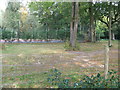
10
Plum Tree Field
The name of the field according to the 1840 tithe map. Part of the field has been lost to the wood on the right which seems to have been planted in the last decade of the 19th century.
Image: © Simon Carey
Taken: 2 Oct 2010
0.15 miles