
IMAGES TAKEN NEAR TO
Little Finches, HORSHAM, RH13 8EY
Introduction
This page details the photographs taken nearby to Little Finches, RH13 8EY by members of the Geograph project.
The Geograph project started in 2005 with the aim of publishing, organising and preserving representative images for every square kilometre of Great Britain, Ireland and the Isle of Man.

There are currently over 7.5m images from over14,400 individuals and you can help contribute to the project by visiting https://www.geograph.org.uk
Image Map
Images are licensed for reuse under creativecommons.org/licenses/by-sa/2.0
Notes
- Clicking on the map will re-center to the selected point.
- The higher the marker number, the further away the image location is from the centre of the postcode.
Image Listing (136 Images Found)
Images are licensed for reuse under creativecommons.org/licenses/by-sa/2.0
Image
Details
Distance
1
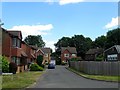
Little Finches, Partridge Green
A cul de sac off Finches Close that was built in the late 1980s on the site of the former Kensett's Brickworks which operated here from the 1880s until the 1920s. Previously it had been a field called Long Two Acres according to West Grinstead's 1841 tithe map. To the right is Image
Image: © Simon Carey
Taken: 9 Aug 2016
0.01 miles
2
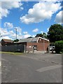
Telephone Exchange, Finches Close, Partridge Green
Built with the estate in the 1970s replacing the former exchange on High Street, see Image
Image: © Simon Carey
Taken: 31 Jul 2016
0.03 miles
3
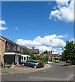
Finches Close, Partridge Green
A cul de sac off Hazelwood Road that was built in the 1970s on the site of the former Kensett's Brickworks which operated here from the 1880s until the 1920s. Previously it had been a field called Long Two Acres according to West Grinstead's 1841 tithe map. Out of shot to the right is Image
Image: © Simon Carey
Taken: 31 Jul 2016
0.04 miles
4
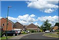
Hazelwood Road, Partridge Green
A cul de sac that runs east then south of South Street. The estate was built in the 1970s on the site of Kensett's Brickworks which operated here from the 1880s until the 1920s with this section having previously been a field called Little Two Acres according to West Grinstead's 1841 tithe map.
Image: © Simon Carey
Taken: 31 Jul 2016
0.05 miles
5
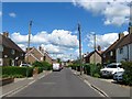
South Street, Partridge Green
The first development away from the High Street with houses appearing in dribs and drabs from the 1870s onwards as the settlement of partridge Green began to develop after the arrival of the railway. The street would also provide access to both Kensett's and Kempshalls Brickworks until the 1950s when both were closed and the former was replaced by a new housing estate whilst the latter became part of Star Road Trading Estate. Prior to the development of the street much of it was a field called Long Field according to West Grinstead's 1841 tithe map.
Image: © Simon Carey
Taken: 31 Jul 2016
0.08 miles
6
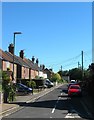
South Street, Partridge Green
The first new road to be built in the settlement of Partridge Green which heads south from High Street with some of the houses visible on the eastern side being erected in the 1860s with more added during the rest of the 19th century to house workers in the brick works at the southern end of the street.
Image: © Simon Carey
Taken: 23 Aug 2016
0.08 miles
7
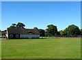
Pavilion, King George's Field, Partridge Green
The main pavilion for sports use on the playing fields which also contains a small social club for those involved.
Image: © Simon Carey
Taken: 11 Sep 2016
0.08 miles
8
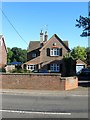
Greensleeves, High Street, Partridge Green
The house dates from the 1860s and was originally known as Westlands.
Image: © Simon Carey
Taken: 6 Aug 2016
0.08 miles
9
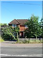
Peelers Croft, High Street, Partridge Green
The name gives away its original use, that of the village's police house. Built in the late 1940s and converted into a private residential dwelling around 2000.
Image: © Simon Carey
Taken: 6 Aug 2016
0.08 miles
10

King George's Field, Partridge Green
The village recreation ground since the 1930s with the section in view here, south of the pavilion, having been once a field called Four Acre Field according to West Grinstead's 1841 tithe map. To the south is Image
Image: © Simon Carey
Taken: 31 Jul 2016
0.08 miles