IMAGES TAKEN NEAR TO
Littleworth Lane, HORSHAM, RH13 8EJ
Introduction
This page details the photographs taken nearby to Littleworth Lane, RH13 8EJ by members of the Geograph project.
The Geograph project started in 2005 with the aim of publishing, organising and preserving representative images for every square kilometre of Great Britain, Ireland and the Isle of Man.

There are currently over 7.5m images from over14,400 individuals and you can help contribute to the project by visiting https://www.geograph.org.uk
Image Map (Loading...)


Getting Data...Please wait
Leaflet Map data © OpenStreetMap
Images are licensed for reuse under creativecommons.org/licenses/by-sa/2.0
Notes
- Clicking on the map will re-center to the selected point.
- The higher the marker number, the further away the image location is from the centre of the postcode.
Image Listing (39 Images Found)
Images are licensed for reuse under creativecommons.org/licenses/by-sa/2.0
Image
Details
Distance
1
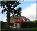
Lancasters Cottage, Littleworth Lane
Built around 1949/50 originally as an agricultural labourer's dwelling though is now a private residence.
Image: © Simon Carey
Taken: 18 Sep 2016
0.00 miles
2
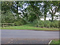
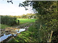
Footpath FP1761/1
Off Littleworth Lane.
Image: © The Saunterer
Taken: 12 Oct 2012
0.04 miles
3
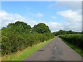
Littleworth Lane
The current lane runs between Partridge Green in the south to the A272 in the north and is an ancient droveway with the section between Littleworth and Danefold Corner forming the parish boundary between Cowfold on the right and West Grinstead to the left.
Image: © Simon Carey
Taken: 18 Sep 2016
0.07 miles
4
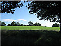
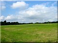
The Coneyburry Field
The name of the field according to the 1840 tithe map which, as the name suggests, was once used as a warren.
Image: © Simon Carey
Taken: 28 Aug 2010
0.08 miles
5
Rail Field/Cart House Field
The name of the fields according to West Grinstead's 1841 tithe map that have been combined to form a larger unit. Rail Field was on the eastern side adjacent to Littleworth Lane part of which has been lost to the construction of Image and Birchfield. Cart House Field was on the western side with Image located in the south west corner. To the south is the drive to Lancaster's Farm beyond which is Image whilst to the north is Image
Image: © Simon Carey
Taken: 18 Sep 2016
0.08 miles
6

Swain's Rough
A wood located on the western side of Littleworth Lane which was known as Swains Plantations on West Grinstead's 1841 tithe map and included Image to the north. To the south is Image
Image: © Simon Carey
Taken: 18 Sep 2016
0.09 miles
7
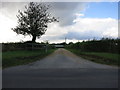
Farm Entrance
Looking west to Lancaster's Farm.
Image: © The Saunterer
Taken: 12 Oct 2012
0.11 miles
8
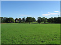
The Grinstead
The name of the field according to the 1840 tithe map. Grinstead House, built in the Edwardian era, is beyond Whilst Swain's Wood is to the right.
Image: © Simon Carey
Taken: 28 Aug 2010
0.12 miles
9
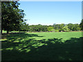
Wood Field
The name of the field according to the 1840 tithe map. Grinstead House was built in the field during the Edwardian era and much of the field is now part of its grounds. The old field boundary is still marked by the trees on the left.
Image: © Simon Carey
Taken: 28 Aug 2010
0.12 miles
10
Field next to Swain's Rough
Footpath Fp 1825
Image: © The Saunterer
Taken: 30 Oct 2012
0.12 miles