IMAGES TAKEN NEAR TO
Tower Hill, HORSHAM, RH13 0JT
Introduction
This page details the photographs taken nearby to Tower Hill, RH13 0JT by members of the Geograph project.
The Geograph project started in 2005 with the aim of publishing, organising and preserving representative images for every square kilometre of Great Britain, Ireland and the Isle of Man.

There are currently over 7.5m images from over14,400 individuals and you can help contribute to the project by visiting https://www.geograph.org.uk
Image Map (Loading...)


Getting Data...Please wait
Leaflet Map data © OpenStreetMap
Images are licensed for reuse under creativecommons.org/licenses/by-sa/2.0
Notes
- Clicking on the map will re-center to the selected point.
- The higher the marker number, the further away the image location is from the centre of the postcode.
Image Listing (7 Images Found)
Images are licensed for reuse under creativecommons.org/licenses/by-sa/2.0
Image
Details
Distance
1
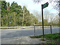
Footpath 1637 crosses the A24
At least you don't have to climb over the central barrier.
Image: © Robin Webster
Taken: 3 Apr 2011
0.17 miles
2
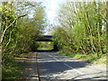
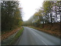
Bridge carrying the A24 over Two Mile Ash Road
Image: © Rod Allday
Taken: 16 Apr 2017
0.18 miles
3
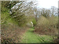
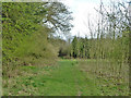
Footpath 1637
Running roughly parallel to the A24, which it crosses at the end of this stretch.
Image: © Robin Webster
Taken: 3 Apr 2011
0.19 miles
4
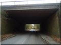
Two Mile Ash Lane
This roadbridge carries the A24
Image: © Stacey Harris
Taken: 26 Nov 2011
0.21 miles

7
Footpath 1637
Running roughly parallel to the A24, which it crosses at the end of this stretch.
Image: © Robin Webster
Taken: 3 Apr 2011
0.23 miles