
IMAGES TAKEN NEAR TO
Canalside, REDHILL, RH1 2FW
Introduction
This page details the photographs taken nearby to Canalside, RH1 2FW by members of the Geograph project.
The Geograph project started in 2005 with the aim of publishing, organising and preserving representative images for every square kilometre of Great Britain, Ireland and the Isle of Man.

There are currently over 7.5m images from over14,400 individuals and you can help contribute to the project by visiting https://www.geograph.org.uk
Image Map
Images are licensed for reuse under creativecommons.org/licenses/by-sa/2.0
Notes
- Clicking on the map will re-center to the selected point.
- The higher the marker number, the further away the image location is from the centre of the postcode.
Image Listing (89 Images Found)
Images are licensed for reuse under creativecommons.org/licenses/by-sa/2.0
Image
Details
Distance
1
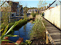
A watery new housing development
All along this new dead-end road runs a man-made stream. Water is the theme of this large development of the former BIS (British Industrial Sand) site. Although externally complete, many of the houses on this road were being fitted out internally.
Image: © Robin Webster
Taken: 16 Nov 2010
0.03 miles
2
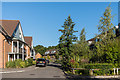
Reeds Meadow
A major housing development on the site of the old Holmethorpe sand quarry, marketed as Watercolour. This is Reeds Meadow, on the northern edge of the development.
Image: © Ian Capper
Taken: 25 Sep 2015
0.04 miles
3
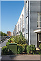
Canalside
A major housing development on the site of the old Holmethorpe sand quarry, marketed as Watercolour. This is Canalside, a boulevard alongside a long strip of water.
Image: © Ian Capper
Taken: 25 Sep 2015
0.05 miles
5
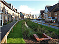
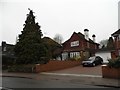
Reeds Meadow, 2010
Water is the theme of this large development of the former BIS (British Industrial Sand) site. Although externally complete, many of the houses on this road were being fitted out internally.
Image: © Robin Webster
Taken: 16 Nov 2010
0.05 miles
6
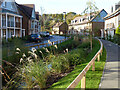
Reeds Meadow, 2010
Water is the theme of this large development of the former BIS (British Industrial Sand) site. Although externally complete, many of the houses on this road were being fitted out internally.
Image: © Robin Webster
Taken: 16 Nov 2010
0.05 miles
7
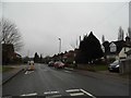
Road narrowing on Nutfield Road
Combined with the bumps it is impossible to drive along a road like this without spoiling your mood. It serves no purpose for drivers or passengers except sheer frustration and potential damage to vehicles.
Image: © David Howard
Taken: 24 Jan 2016
0.06 miles
8
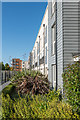
Canalside
A major housing development on the site of the old Holmethorpe sand quarry, marketed as Watercolour. This is Canalside, a boulevard alongside a long strip of water.
Image: © Ian Capper
Taken: 25 Sep 2015
0.08 miles
10
Thornton Rise
A major housing development on the site of the old Holmethorpe sand quarry, marketed as Watercolour. This is Thornton Rise, on the northern edge of the development.
Image: © Ian Capper
Taken: 25 Sep 2015
0.11 miles