
IMAGES TAKEN NEAR TO
Green Lane, REDHILL, RH1 2DQ
Introduction
This page details the photographs taken nearby to Green Lane, RH1 2DQ by members of the Geograph project.
The Geograph project started in 2005 with the aim of publishing, organising and preserving representative images for every square kilometre of Great Britain, Ireland and the Isle of Man.

There are currently over 7.5m images from over14,400 individuals and you can help contribute to the project by visiting https://www.geograph.org.uk
Image Map
Images are licensed for reuse under creativecommons.org/licenses/by-sa/2.0
Notes
- Clicking on the map will re-center to the selected point.
- The higher the marker number, the further away the image location is from the centre of the postcode.
Image Listing (43 Images Found)
Images are licensed for reuse under creativecommons.org/licenses/by-sa/2.0
Image
Details
Distance
1
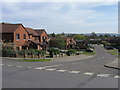
Colebrooke Road
A 1990s development of "affordable housing" off Green Lane in Redhill, replacing an area of 1950s flats and houses. The photo shows the way the road climbs up from an area of lower ground - old maps show a stream running from left to right across this area, which was presumably the Cole Brook. There is no sign of it now, suggesting that it has been culverted.
Image: © Ian Capper
Taken: 26 Apr 2008
0.04 miles
2
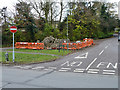
Excavation in island at end of Batts Hill
At the junction with Green Lane.
Image: © Robin Webster
Taken: 17 Nov 2010
0.05 miles
3
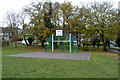
Basketball practice area
On the small play area on the corner of Green Lane and Green Way.
Image: © Robin Webster
Taken: 17 Nov 2010
0.08 miles
4
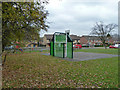
Half a basketball court off Green Lane
Image: © Robin Webster
Taken: 17 Nov 2010
0.08 miles
5
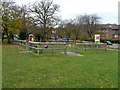
Green Way Playground
On a small green by Green Way.
Image: © Robin Webster
Taken: 17 Nov 2010
0.09 miles
6
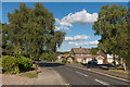
Daneshill
A road of 1960s housing off Batts Hill.
Image: © Ian Capper
Taken: 3 Aug 2014
0.11 miles
7
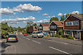
Coniston Way
A road of housing off Batts Hill, part of a large area between Linkfield Lane and Carlton Road developed in the 1960s.
Image: © Ian Capper
Taken: 3 Aug 2014
0.13 miles
8
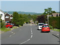
Coniston Way, Redhill
Looking down Coniston Way, with the North Downs in the distance.
Image: © Peter Trimming
Taken: 24 May 2009
0.14 miles
9
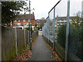
Path from Colebrooke Road to Timperley Gardens
An oddly high fence on the right, odd because the site is open to the road.
Image: © Robin Webster
Taken: 17 Nov 2010
0.14 miles
10
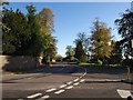
Batts Hill, Redhill
At the junction with Coniston Way (right).
Image: © Derek Harper
Taken: 15 Oct 2011
0.14 miles