
IMAGES TAKEN NEAR TO
Churchill Way, HORSHAM, RH12 3TY
Introduction
This page details the photographs taken nearby to Churchill Way, RH12 3TY by members of the Geograph project.
The Geograph project started in 2005 with the aim of publishing, organising and preserving representative images for every square kilometre of Great Britain, Ireland and the Isle of Man.

There are currently over 7.5m images from over14,400 individuals and you can help contribute to the project by visiting https://www.geograph.org.uk
Image Map
Images are licensed for reuse under creativecommons.org/licenses/by-sa/2.0
Notes
- Clicking on the map will re-center to the selected point.
- The higher the marker number, the further away the image location is from the centre of the postcode.
Image Listing (28 Images Found)
Images are licensed for reuse under creativecommons.org/licenses/by-sa/2.0
Image
Details
Distance
1
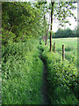
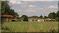
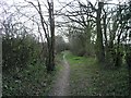
Bridleway 1630 from Broadbridge Heath approaching Broadbridge Farm
This bridleway was once the road leading from Broadbridge Heath to Itchingfield. It now connects Broadbridge Heath to the Downs Link long-distance footpath.
Image: © Andy Potter
Taken: 31 May 2006
0.09 miles
2
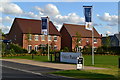
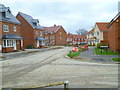
New homes and flags at Wickhurst Green
Major new housing development on the edge of Broadbridge Heath.
Image: © David Martin
Taken: 10 Aug 2014
0.13 miles
3
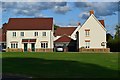
New housing at Wickhurst Green
Major new housing development on the edge of Broadbridge Heath.
Image: © David Martin
Taken: 10 Aug 2014
0.13 miles
4
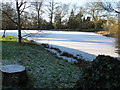
Frozen Millpond near Broadbridge Farm
In the background is Mill Cottage and Mill House
Image: © Dave Spicer
Taken: 2 Jan 2010
0.15 miles
8
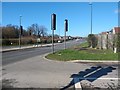
Looking West along the A264 from old Wickhurst Lane
Image: © Thoma
Taken: 16 Mar 2020
0.17 miles
10
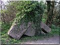
WW2 roadblock on Mill Lane
Situated immediately south of Image this overturned roadblock is one of a pair. Together they would limit the width of the road and, by the insertion of a beam or railway rails into the slot at the top, completely block the road.
Image: © Andy Potter
Taken: 7 Apr 2007
0.19 miles