WW2 roadblock on Mill Lane
Introduction
The photograph on this page of WW2 roadblock on Mill Lane by Andy Potter as part of the Geograph project.
The Geograph project started in 2005 with the aim of publishing, organising and preserving representative images for every square kilometre of Great Britain, Ireland and the Isle of Man.

There are currently over 7.5m images from over 14,400 individuals and you can help contribute to the project by visiting https://www.geograph.org.uk
WW2 roadblock on Mill Lane
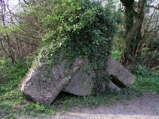
Image: © Andy Potter Taken: 7 Apr 2007
Situated immediately south of Image this overturned roadblock is one of a pair. Together they would limit the width of the road and, by the insertion of a beam or railway rails into the slot at the top, completely block the road.
Images are licensed for reuse under creativecommons.org/licenses/by-sa/2.0
Image Location
Latitude
51.061023
Longitude
-0.369756