IMAGES TAKEN NEAR TO
Redford Avenue, HORSHAM, RH12 2HP
Introduction
This page details the photographs taken nearby to Redford Avenue, RH12 2HP by members of the Geograph project.
The Geograph project started in 2005 with the aim of publishing, organising and preserving representative images for every square kilometre of Great Britain, Ireland and the Isle of Man.

There are currently over 7.5m images from over14,400 individuals and you can help contribute to the project by visiting https://www.geograph.org.uk
Image Map
Images are licensed for reuse under creativecommons.org/licenses/by-sa/2.0
Notes
- Clicking on the map will re-center to the selected point.
- The higher the marker number, the further away the image location is from the centre of the postcode.
Image Listing (54 Images Found)
Images are licensed for reuse under creativecommons.org/licenses/by-sa/2.0
Image
Details
Distance
3
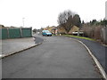
Side of house on Redford Avenue
Facing onto Warnham Road
Image: © David Howard
Taken: 30 Jan 2017
0.07 miles
6
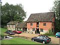
Warnham Mill
No longer a working mill but offices. Image is behind the trees at the left of this shot.
Image: © Andy Potter
Taken: 13 Sep 2006
0.10 miles
7
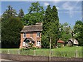
Mill House
Until a few years ago this house always had very tidy plots of vegetables in the lawns in front of the house.
I suspect that this was the house of the miller that owned Image which is 100m to the left. If you know, one way or the other, please get in touch.
Image: © Andy Potter
Taken: 22 May 2007
0.11 miles
8
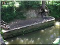
Dock-like embankment
This vertical wall protects the bank of Boldings Brook immediately south of Image and looks remarkably like a dock. I don't think the river was ever navigable to the south and the north is blocked by the Image I don't know if this structure was part of the 1928 bridge rebuild or if it is a remnant of something earlier. It is accessible, by some steps, from the Horsham Riverside Walk http://www.horsham.gov.uk/leisure_and_tourism/leisure_315.asp.
Image: © Andy Potter
Taken: 22 May 2007
0.13 miles
9
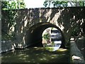
Warnham Mill Bridge
A road from Horsham to Dorking was recorded in the late 13th or early 14th century and almost certainly would have crossed the river at the site of the modern bridge. A bridge on this site was first recorded in 1509 and a stone bridge mentioned in 1635. The modern bridge was built in 1928 to accommodate the widened Warnham Road (B2237). It appears to be of concrete poured to form a tube-shaped arch with a facing of natural stone. Seen from Image south of the bridge Image is visible through the arch.
Image: © Andy Potter
Taken: 22 May 2007
0.14 miles