
IMAGES TAKEN NEAR TO
St. Annes Boulevard, REDHILL, RH1 1AX
Introduction
This page details the photographs taken nearby to St. Annes Boulevard, RH1 1AX by members of the Geograph project.
The Geograph project started in 2005 with the aim of publishing, organising and preserving representative images for every square kilometre of Great Britain, Ireland and the Isle of Man.

There are currently over 7.5m images from over14,400 individuals and you can help contribute to the project by visiting https://www.geograph.org.uk
Image Map
Images are licensed for reuse under creativecommons.org/licenses/by-sa/2.0
Notes
- Clicking on the map will re-center to the selected point.
- The higher the marker number, the further away the image location is from the centre of the postcode.
Image Listing (52 Images Found)
Images are licensed for reuse under creativecommons.org/licenses/by-sa/2.0
Image
Details
Distance
1
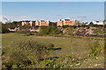
The Moors
Looking across The Moors to the embankment of the Quarry Line (the section of the London - Brighton railway that bypasses Redhill) with the Park 25 development beyond.
Image: © Ian Capper
Taken: 21 Apr 2012
0.11 miles
2
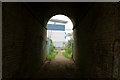
Under the Railway Line
The path links a nature reserve, to an industrial estate, just north of Redhill. The bridge carries the London to Brighton railway line, with this (fast) line avoiding Redhill.
Image: © Peter Trimming
Taken: 10 Dec 2013
0.11 miles

4
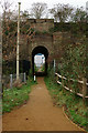
Railway Bridge Near Redhill, Surrey
Seen from the edge of a nature reserve, and looking towards an industrial estate.
Image: © Peter Trimming
Taken: 10 Dec 2013
0.12 miles
5

Footpath under Quarry Line
Footpath under the Quarry Line (the name given to the fast lines built by the London Brighton and South Coast Railway in 1899 avoiding Redhill station).
Image: © Ian Capper
Taken: 17 Jan 2022
0.12 miles
6

Footpath under Quarry Line
Footpath under the Quarry Line (the name given to the fast lines built by the London Brighton and South Coast Railway in 1899 avoiding Redhill station). Originally the path went straight on beyond the bridge, but following the development of the Holmethorpe Industrial Estate it now turns sharp right to meet Holmethorpe Avenue.
Image: © Ian Capper
Taken: 17 Jan 2022
0.12 miles
7
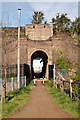
Narrow bridge
Footpath under the Quarry Line (the section of the London - Brighton railway that bypasses Redhill) leading into the Holmethorpe Industrial Estate.
Image: © Ian Capper
Taken: 21 Apr 2012
0.12 miles
8
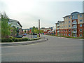
St Anne's Boulevard
Recent development of the former Foxboro Yoxall site, an instrument manufacturer which was based here from 1958 to 1991. After closure, the site remained derelict for many years, before development, partly as an industrial park and partly, in the late 2000s, for housing in an area named Park 25.
The name St Anne's Boulevard refers to St Anne's, an imposing building dating from 1884, housing in turn a school, a hospital and finally a County Council run old people's home, which stood to the south of this site. It was demolished in 1987.
Image: © Ian Capper
Taken: 4 May 2009
0.13 miles
10
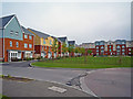
Park 25
Park 25 is a late 2000s development on the former Foxboro Yoxall site. Foxboro Yoxall were an instrument manufacturer which was based here from 1958 to 1991. After closure, the site remained derelict for many years, before development partly as an industrial park and partly for housing, as here.
This is Barrow Gardens, with Parkham House beyond.
Image: © Ian Capper
Taken: 4 May 2009
0.14 miles