
IMAGES TAKEN NEAR TO
Wooding Grove, CRAWLEY, RH11 9PN
Introduction
This page details the photographs taken nearby to Wooding Grove, RH11 9PN by members of the Geograph project.
The Geograph project started in 2005 with the aim of publishing, organising and preserving representative images for every square kilometre of Great Britain, Ireland and the Isle of Man.

There are currently over 7.5m images from over14,400 individuals and you can help contribute to the project by visiting https://www.geograph.org.uk
Image Map
Images are licensed for reuse under creativecommons.org/licenses/by-sa/2.0
Notes
- Clicking on the map will re-center to the selected point.
- The higher the marker number, the further away the image location is from the centre of the postcode.
Image Listing (42 Images Found)
Images are licensed for reuse under creativecommons.org/licenses/by-sa/2.0
Image
Details
Distance
1
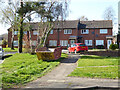
Houses, Woodwards, Broadfield, Crawley
Image: © Robin Webster
Taken: 30 Mar 2021
0.03 miles
3
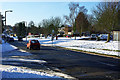
Creasys Drive, Crawley
This area of Crawley is one of the newer developments, so nearly all roads are laid out with modern thinking. However, no thought seems to have been given to snow and ice. Many side turnings, where all the housing is, are up or down rises, making getting out or getting in hazardous and sometimes impossible, as they are never salted like the main routes.
Image: © Robin Webster
Taken: 19 Dec 2009
0.04 miles
4
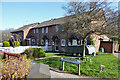
Houses, Woodwards, Broadfield, Crawley
Image: © Robin Webster
Taken: 30 Mar 2021
0.06 miles
5
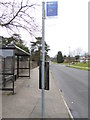
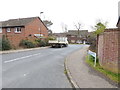
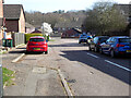
Looking along Creasys Drive to the junction with Chippendale Road
Image: © Shazz
Taken: 3 Apr 2016
0.06 miles
7
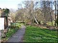
Path by flats on Southbrook, Broadfield, Crawley
The brook is to the right and is actually Broadfield Brook.
Image: © Robin Webster
Taken: 30 Mar 2021
0.08 miles
8
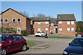
Flats, Hillingdale, Broadfield, Crawley
Image: © Robin Webster
Taken: 30 Mar 2021
0.08 miles
9
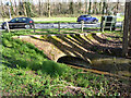
Broadfield Brook passes under Tollgate Hill, Broadfield, Crawley
Image: © Robin Webster
Taken: 30 Mar 2021
0.10 miles
10
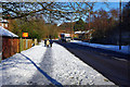
Tollgate Hill, Crawley
A bus route, so the road surface is well salted. The pavements, however, are a different matter - the central glazed area is very slippery and it is best to walk on the uncompacted snow.
Image: © Robin Webster
Taken: 19 Dec 2009
0.11 miles