IMAGES TAKEN NEAR TO
Furzefield, CRAWLEY, RH11 7JU
Introduction
This page details the photographs taken nearby to Furzefield, RH11 7JU by members of the Geograph project.
The Geograph project started in 2005 with the aim of publishing, organising and preserving representative images for every square kilometre of Great Britain, Ireland and the Isle of Man.

There are currently over 7.5m images from over14,400 individuals and you can help contribute to the project by visiting https://www.geograph.org.uk
Image Map
Images are licensed for reuse under creativecommons.org/licenses/by-sa/2.0
Notes
- Clicking on the map will re-center to the selected point.
- The higher the marker number, the further away the image location is from the centre of the postcode.
Image Listing (68 Images Found)
Images are licensed for reuse under creativecommons.org/licenses/by-sa/2.0
Image
Details
Distance
1
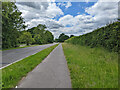
A23 Crawley Avenue, Crawley
There are foot/cycle paths to each side of the dual carriageway. It is quite a busy road, but traffic is periodically interrupted by traffic lights.
Image: © Robin Webster
Taken: 28 May 2022
0.03 miles
2
A23 Crawley Avenue, Crawley
There are foot/cycle paths to each side of the dual carriageway. It is quite a busy road, but traffic is periodically interrupted by traffic lights.
Image: © Robin Webster
Taken: 28 May 2022
0.05 miles
3
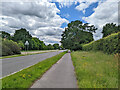
A23 Crawley Avenue, Crawley
There are foot/cycle paths to each side of the dual carriageway. It is quite a busy road, but traffic is periodically interrupted by traffic lights.
Image: © Robin Webster
Taken: 28 May 2022
0.06 miles
5
A23 Crawley Avenue, Crawley
There are foot/cycle paths to each side of the dual carriageway.
Image: © Robin Webster
Taken: 28 May 2022
0.09 miles
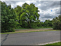
6
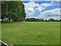
Ewhurst Playing Field, Ifield, Crawley
Image: © Robin Webster
Taken: 28 May 2022
0.09 miles
7
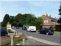
Furzefield, West Green, Crawley
A sort of crescent off Deerswood Road.
Image: © Robin Webster
Taken: 1 Sep 2013
0.10 miles
8
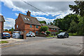
Houses at end of The Mardens, Ifield, Crawley
The tile-hung pair may predate the A23 Crawley bypass (late 1930s), when The Mardens and Ifield Road were part of a continuous direct route from the old Crawley to the old Ifield. Even after the bypass was built, the route was continuous via a roundabout here. This must have been eliminated with the post-war coming of the New Town.
Image: © Robin Webster
Taken: 28 May 2022
0.10 miles
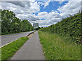
9
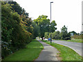
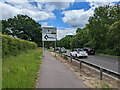
Path by A23 Crawley Avenue
Pedestrians and cyclists share this.
Image: © Robin Webster
Taken: 1 Sep 2013
0.10 miles
10
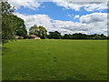
Ewhurst Playing Field, Ifield, Crawley
Image: © Robin Webster
Taken: 28 May 2022
0.10 miles